Earthquake
The 2016 Kumamoto Earthquake [日本語レポート] (first report: 2016/4/15, last update: 2016/4/28)
(Notice) This preliminary report may be updated in near future.
1. Earthquake
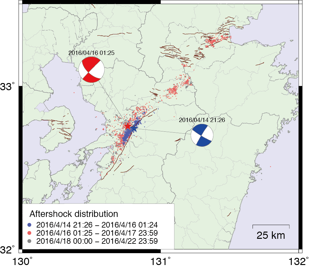
Mj6.5 earthquake event hit Kumamoto prefecture, Japan, at 21:26, April 14th (local time: GMT+09), 2016. Second Mj7.3 earthquake event hit Kumamoto and Oita prefectures at 01:46, April 16th (local time: GMT+09). The epicenters were estimated in about 10km distance, and the hypocenter depths were 11km and 12km, respectively [1,2]. Japan Meteorological Agency (JMA) named the sequence of earthquakes 'The 2016 Kumamoto Earthquake' [3]. CMT solutions (source mechanism) imply right lateral faultings for both events [4]. Blue and red points in following figure are the epicenters of aftershocks, following the first and the second events, respectively. The hypocenters are distributed along the Futagawa fault and Hinagu fault, and also strike angles are estimated in the direction of the faults. Therefore, some relationships between the earthquake events and the faults are expected. Notice that seismic activity is extended to Oita prefecture, north-eastern region of Kumamoto prefecture.
2. Ground Motion
Seismic intensity 7 (maximum value) of JMA scale was observed at Mashiki town during the 1st event, Apr. 14th. Observation of seismic intensity 7 has been the third cases since operating the automatical observation of the intensity. On the other hand, no seismic intensity 6+ are observed. This implies that severe damages are concentrated only in some local area. Seismic intensity 7 were also observed at Mashiki and Nishihara towns during the 2nd event, Apr. 16th. Seismic intensity 6+ were observed at several cities and towns. This implies that relatively large areas were affected due to the 2nd event.
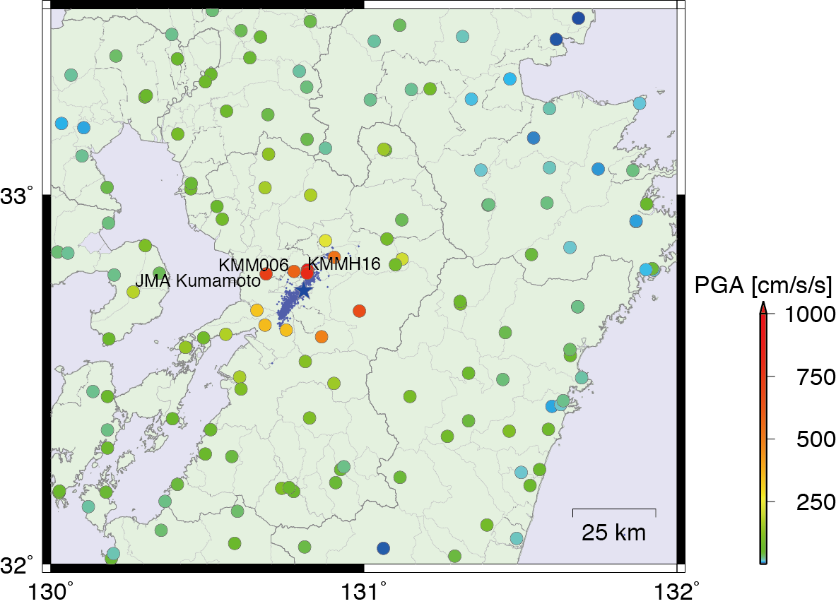
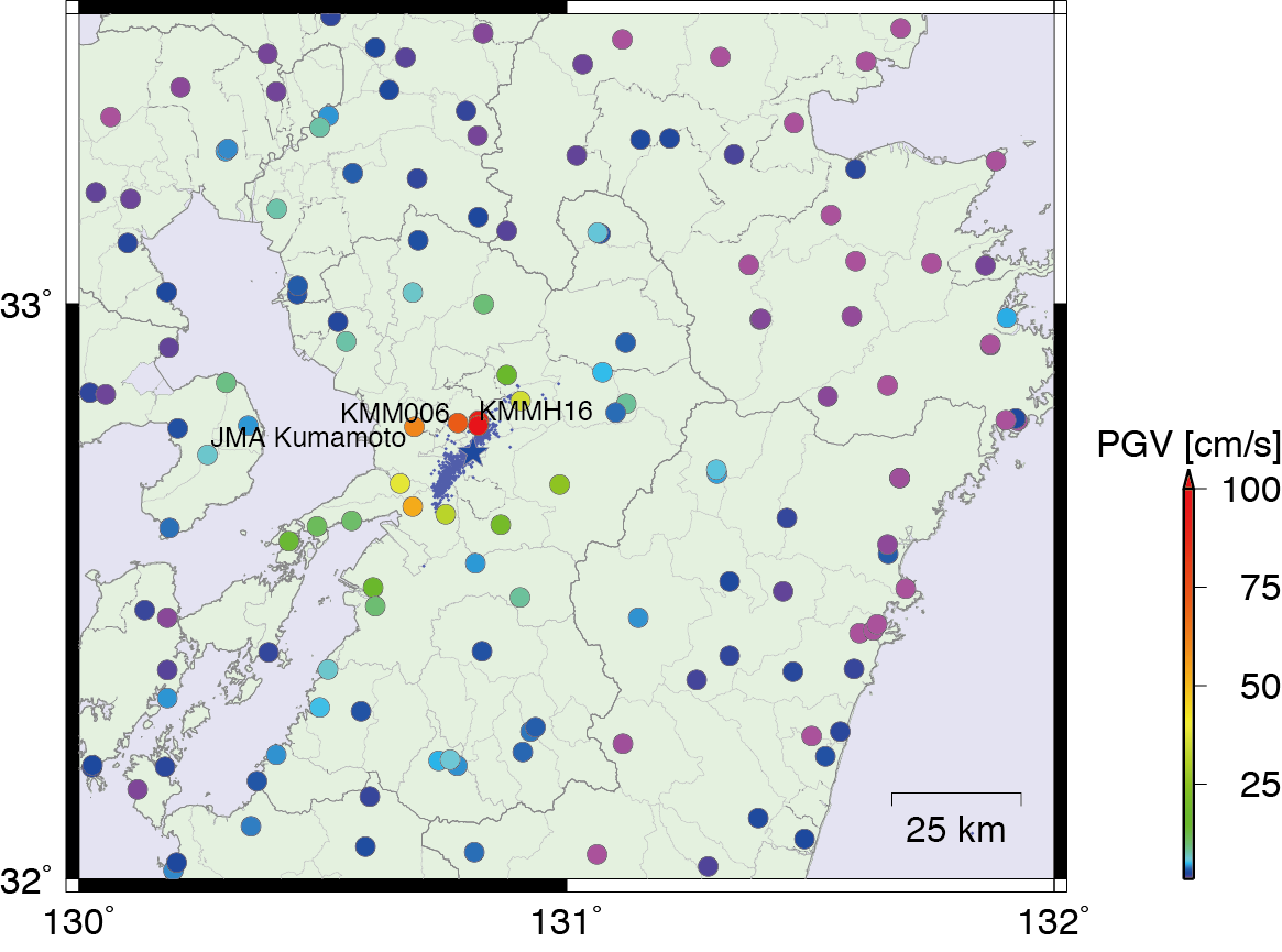
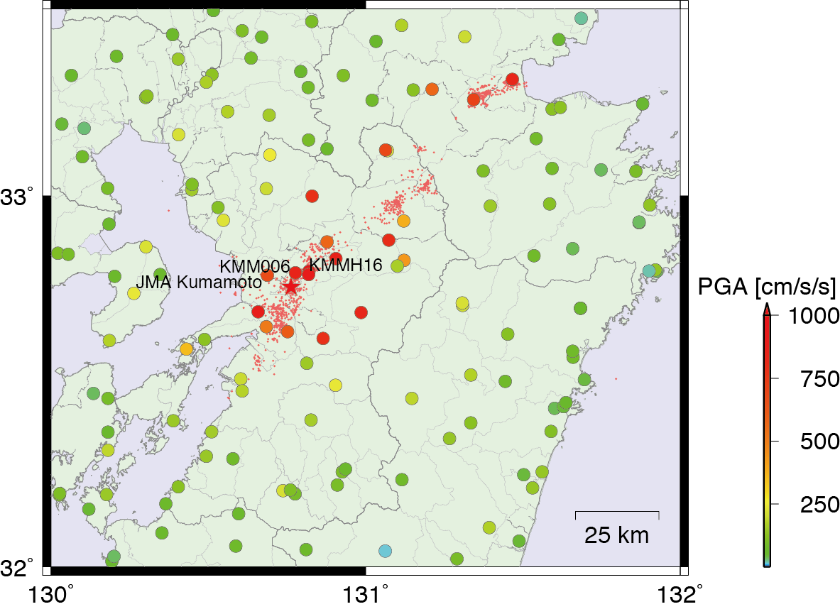
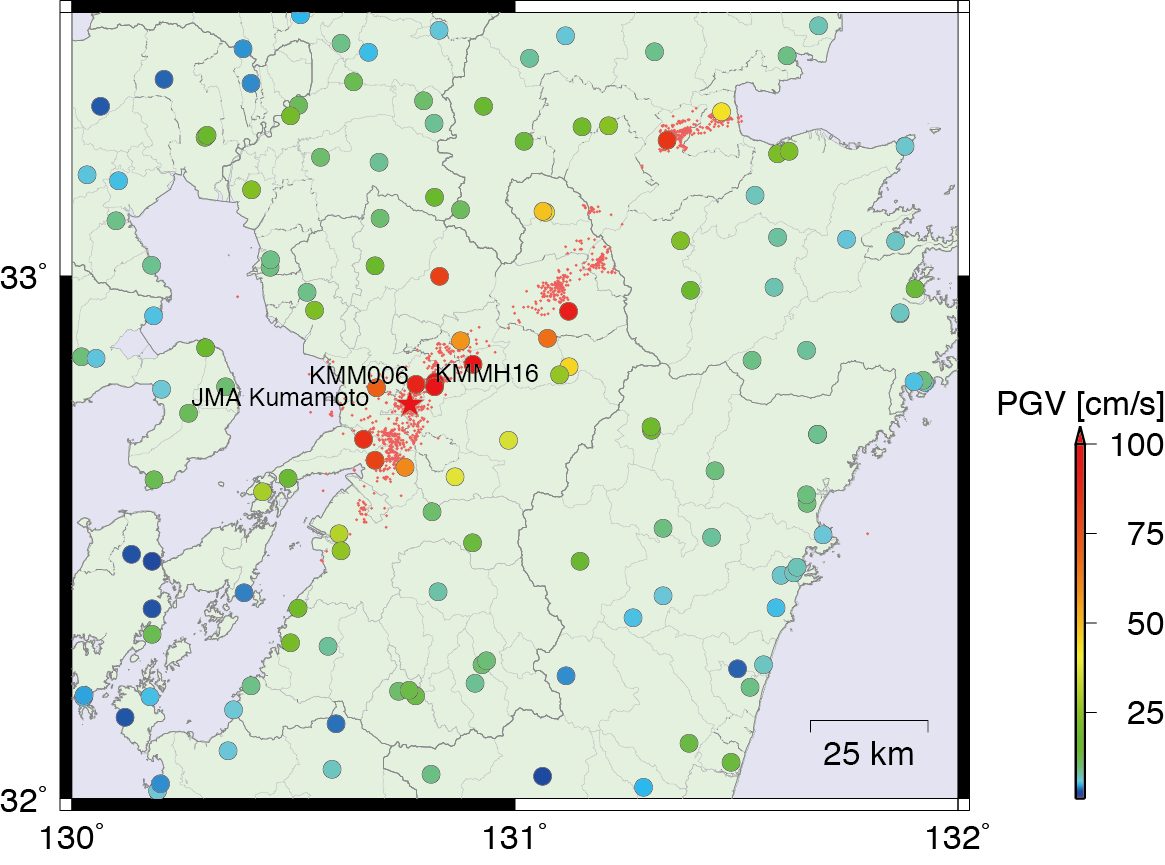
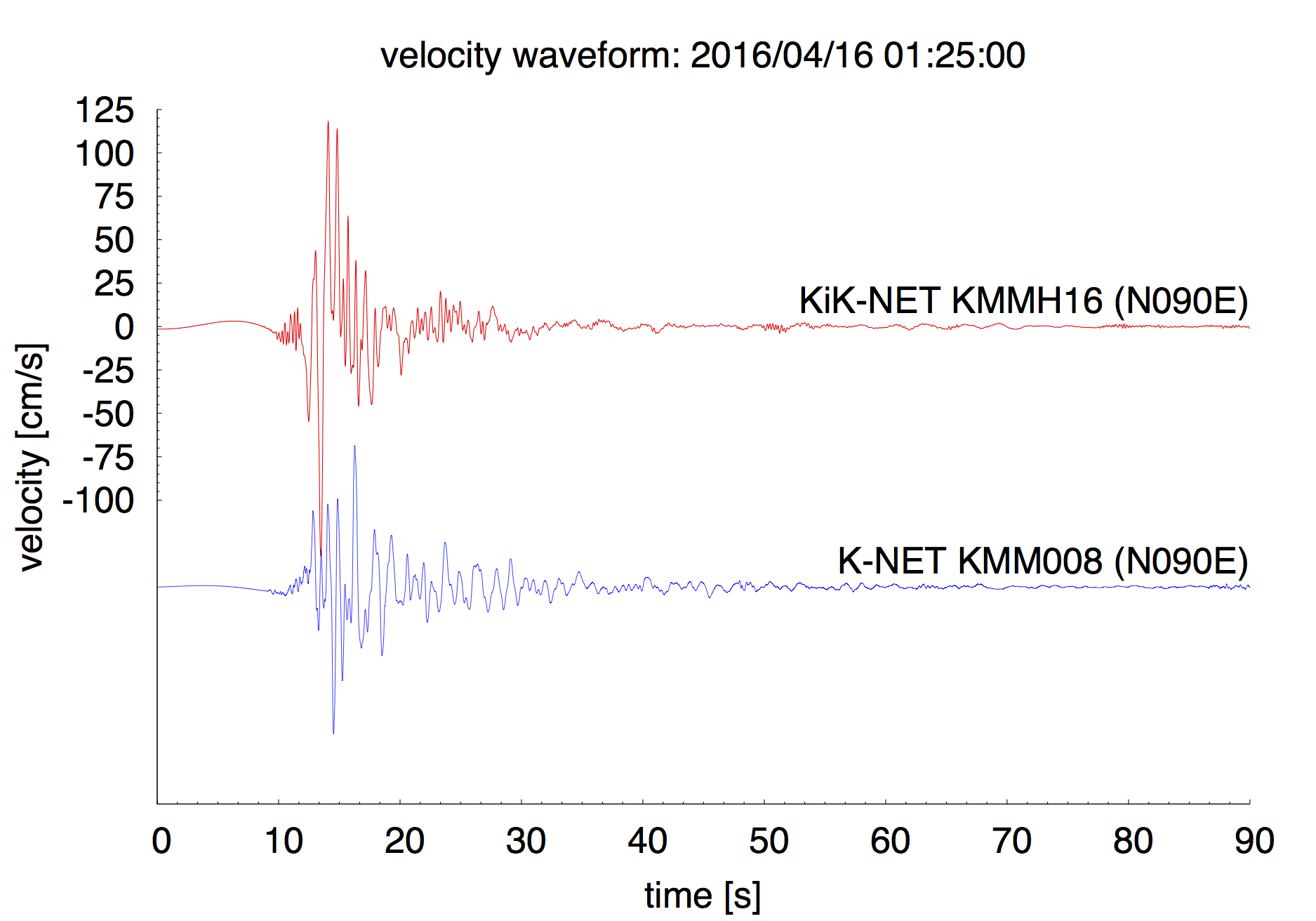
Peak values of horizontal accerelations (PGA) and velocities (PGV) are plotted in following figures. Large PGV area (>50cm/s) was limited during the 1st event, while was extended to Kumamoto and Oita prefectures during the 2nd event. Significant records of ground motion were observed at KiK-net KMMH16 (PGA=925cm/s/s and PGV=92cm/s during 1st event, and PGA=1314cm/s/s and PGV=133cm/s during 2nd event), and Mashiki town office (PGA=815cm/s/s and PGV=138cm/s during 1st event, and PGA=896cm/s/s and PGV=182cm/s during 2nd event).
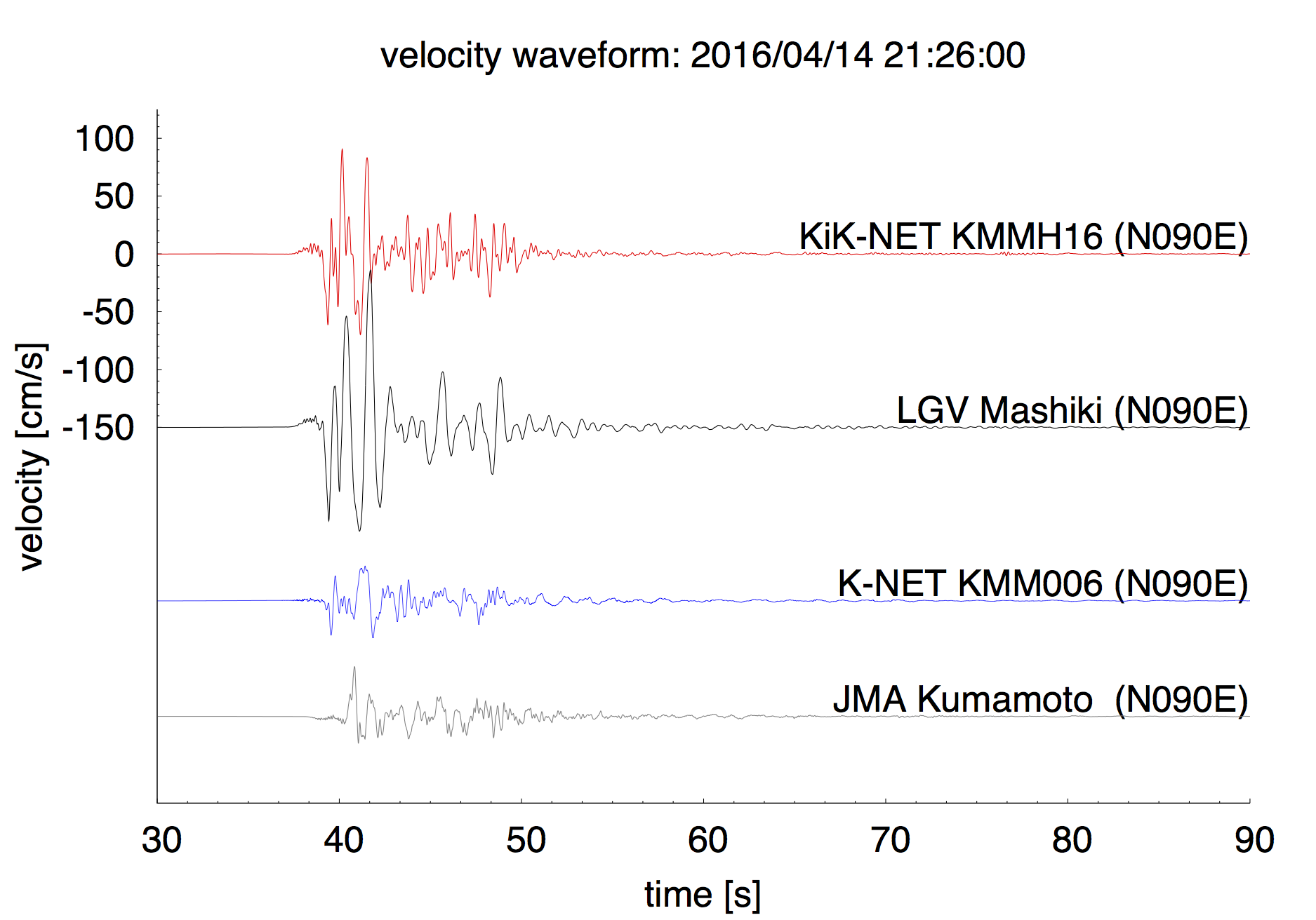
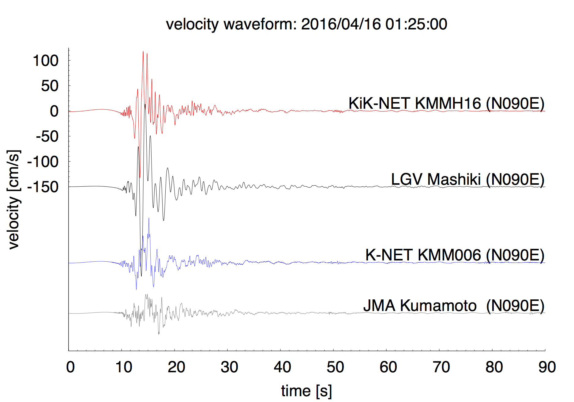
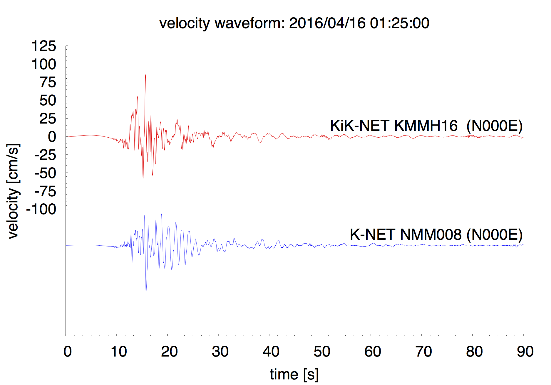
Velocity waveforms at KiK-net KMMH16, Mashiki town office (LGV Mashiki), K-NET KMM006, and JMA Kumamoto are compared. Pulse-like wave packets following the S-wave arrival were recognized during the 1st event. Clear triangle-like phase was observed during the 2nd event. Larger amplitudes were observed during the 2nd event.


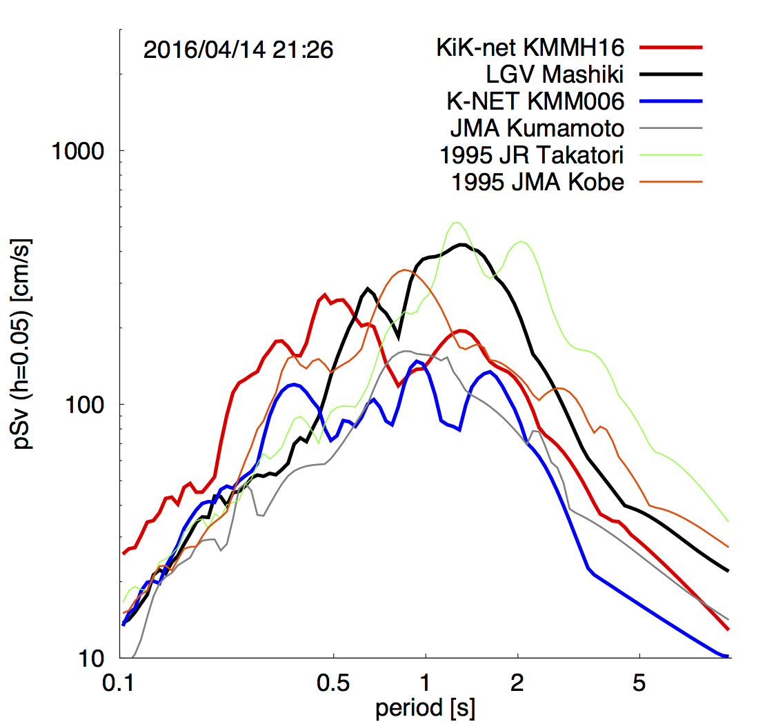
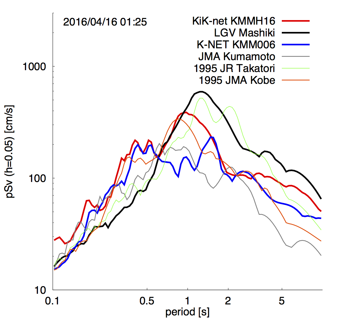
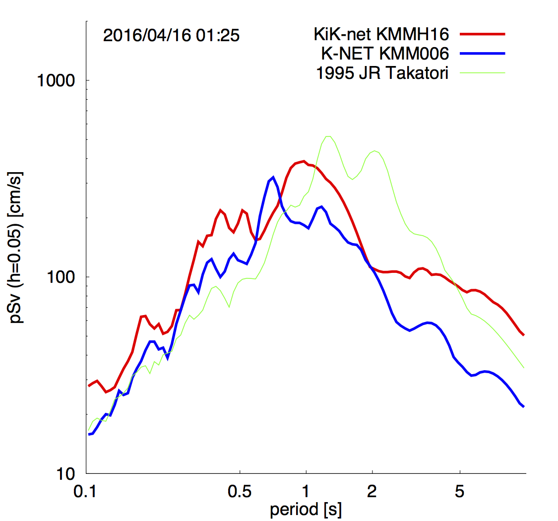
Frequency contents of ground motions are discussed on the basis of pseudo velocity response spectrum (h=0.05). Similar levels with JR Takatori wave during the 1995 Kobe earthquake were observed shorter than 0.5 seconds for both 1st and 2nd events. On the other hand, ground motion levels around 1.0 second for 2nd event are larger than ones for 1st event. Peak periods of the spectra are 0.47s and 0.98s for 1st and 2nd events. It implies 2nd event radiated longer period components relative to 1st ones. In addition, response levels of Mashiki town office (LGV Mashiki) exceed JR Takatori wave in a range of 0.6-1.8 seconds.
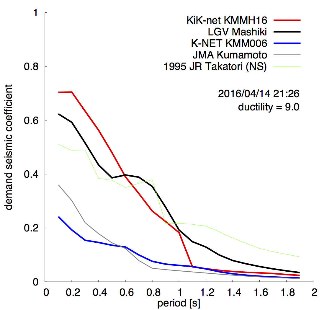
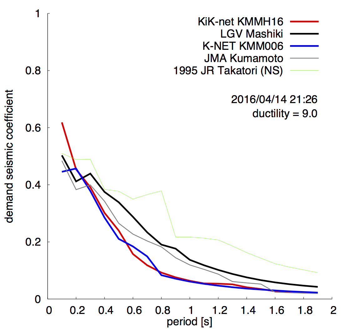
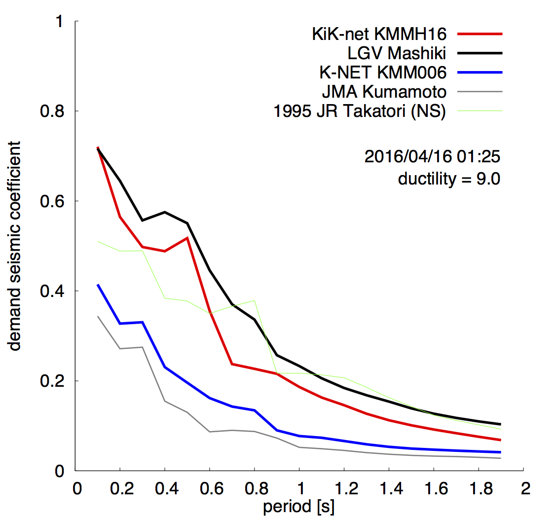
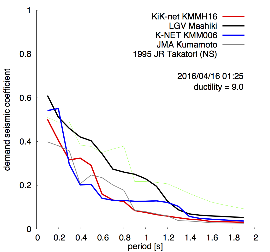
Notice that structure responses under the strong ground motion are nonlinear (elasto-plastic deformation). Following figures are demand curves for 9.0 of ductility. NS components of the curves are similar among three sites, while EW components show large values, especially in the range of 0.2-0.5 seconds of elastic dominant periods.
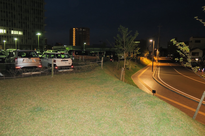
3. Reconnaissance report
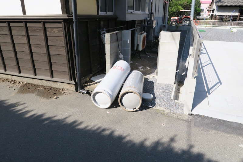
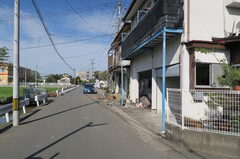
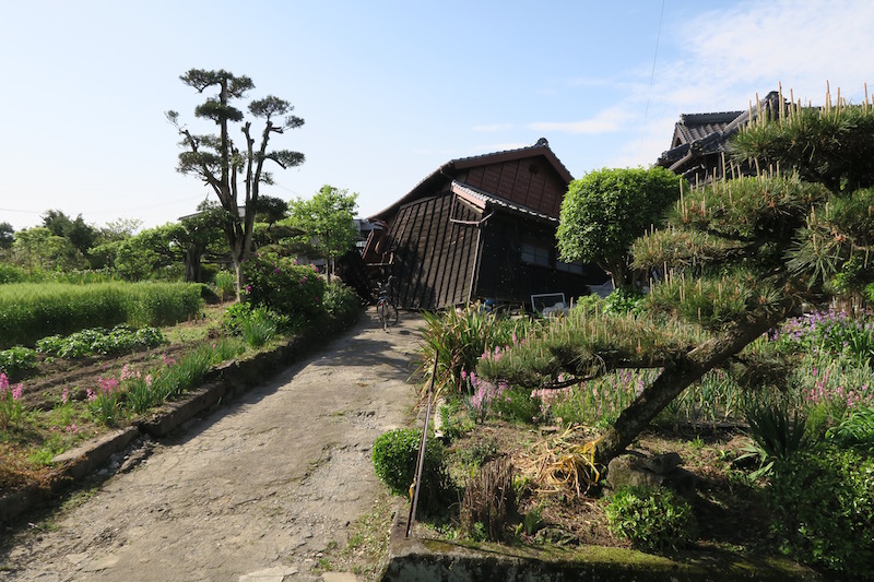
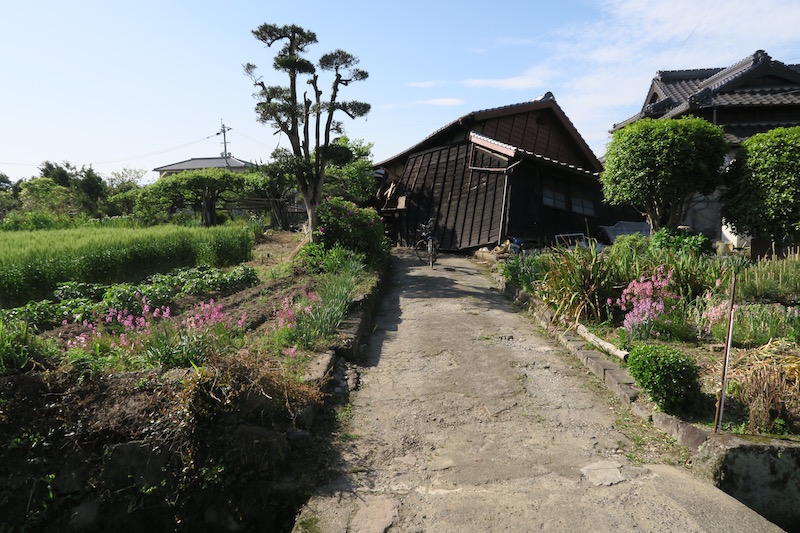
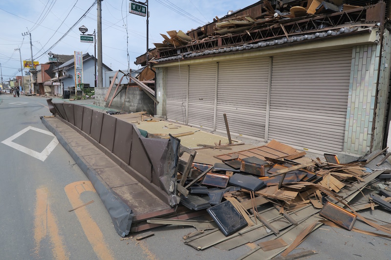
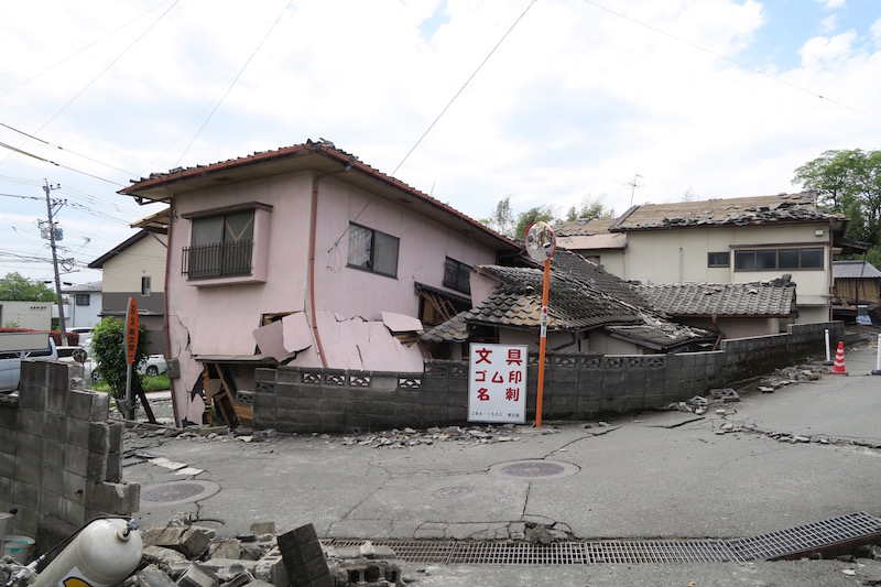
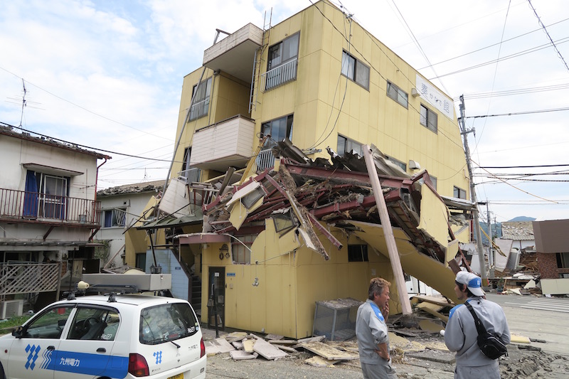
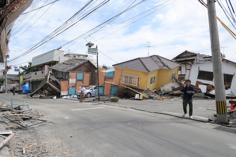
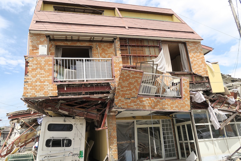
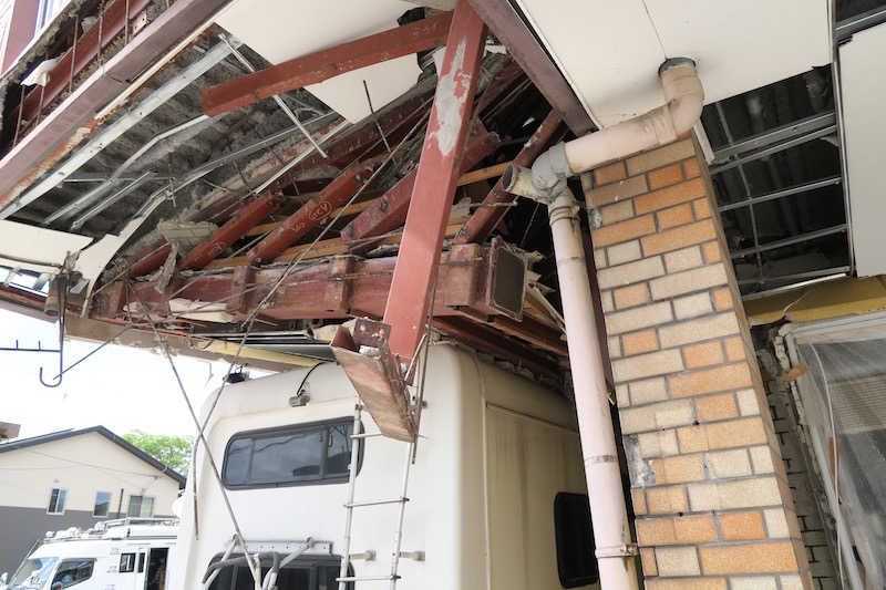
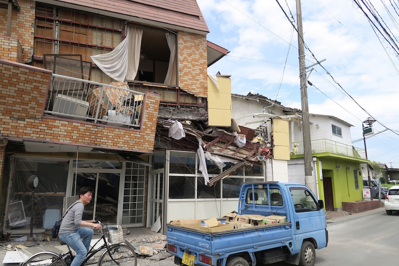
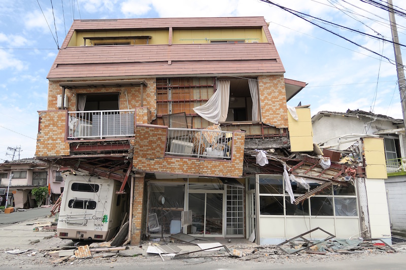
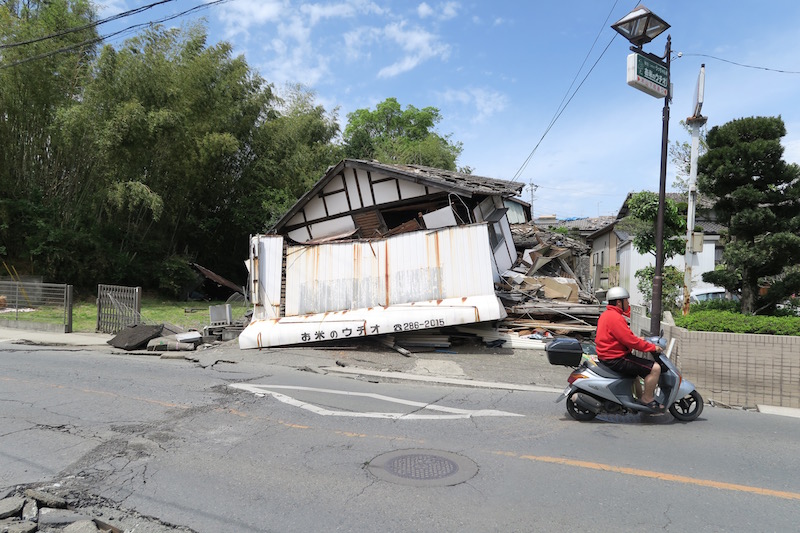
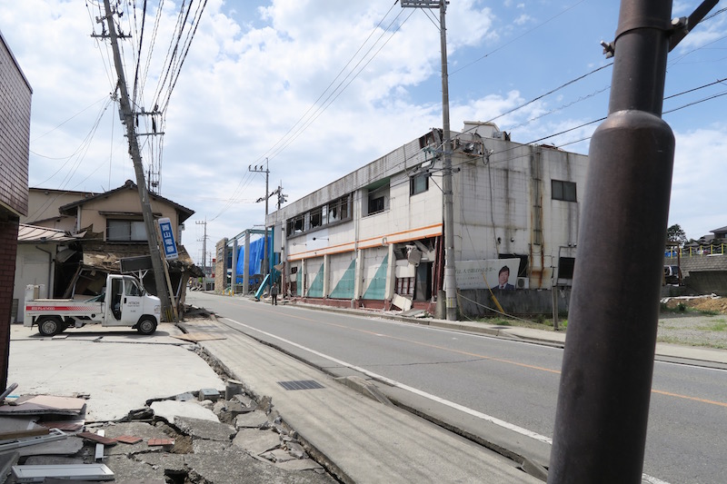
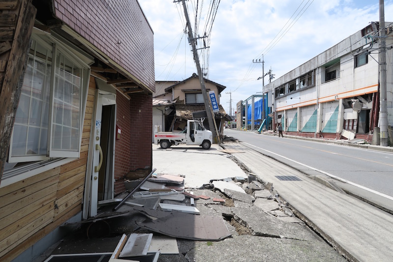
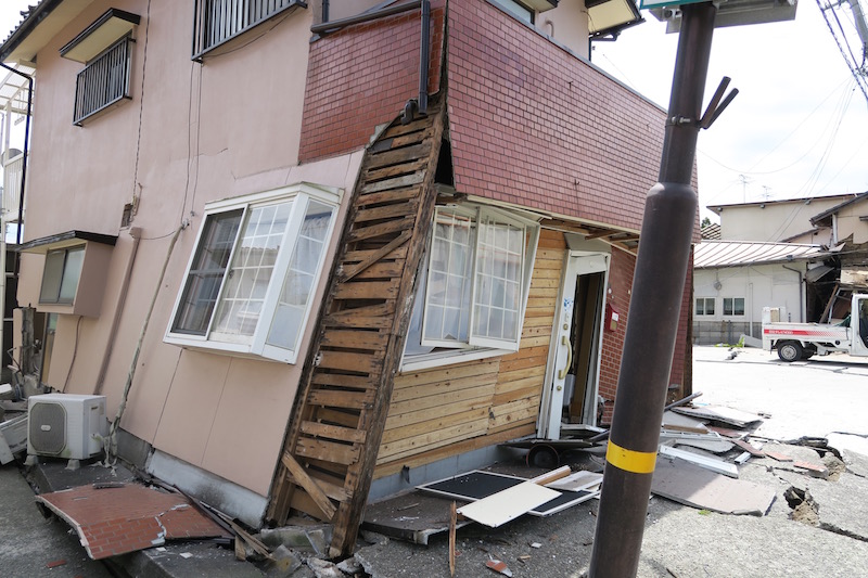
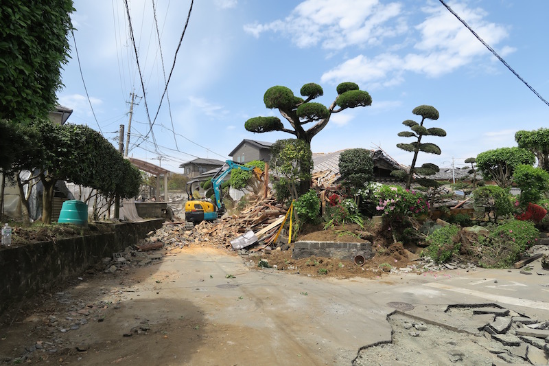
Field reconnaissance was planned as the member of reconnaissance team in earthquake engineering commitee in JSCE. I and Yasuhiro Fukushima (Eight-Japan Engineering Consultants Inc.) visited the Kumamoto area during 15-17th, April. Damages caused by the 2nd event, April 16th, are significant and widespread. 1st event caused local damages in Mashiki town, failure of embankment of Kyushu expressway, and derailment of Kyushu Shinkan-sen. 2nd event caused severe residential damages from Uto city to Mashiki town. I uploded some photos of the major damages in Kumamoto area.
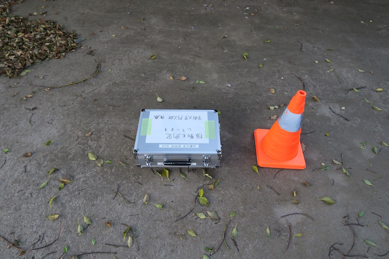
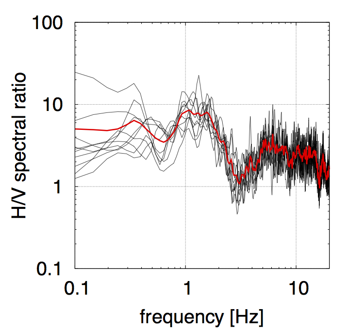
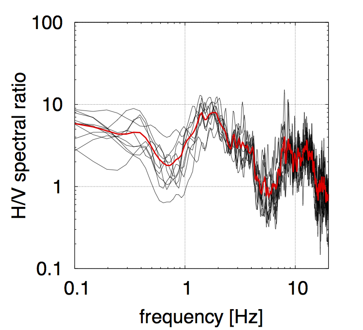
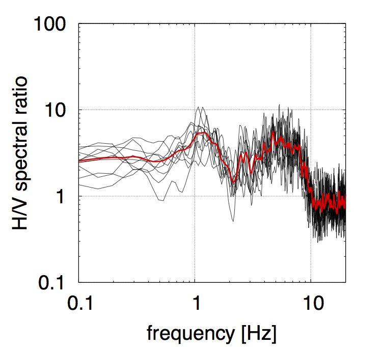
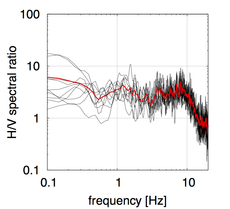
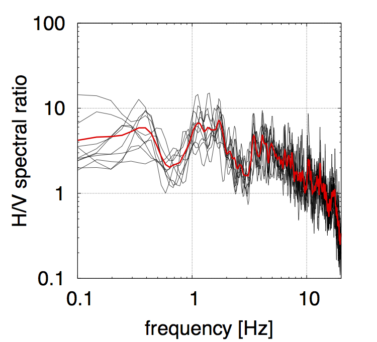
In this reconnaissance, I performed single-site observation of microtremor. Horizontal to vertical spectral ratios are shown with the photos. It should be noted that the measurement records were influenced by aftershocks.
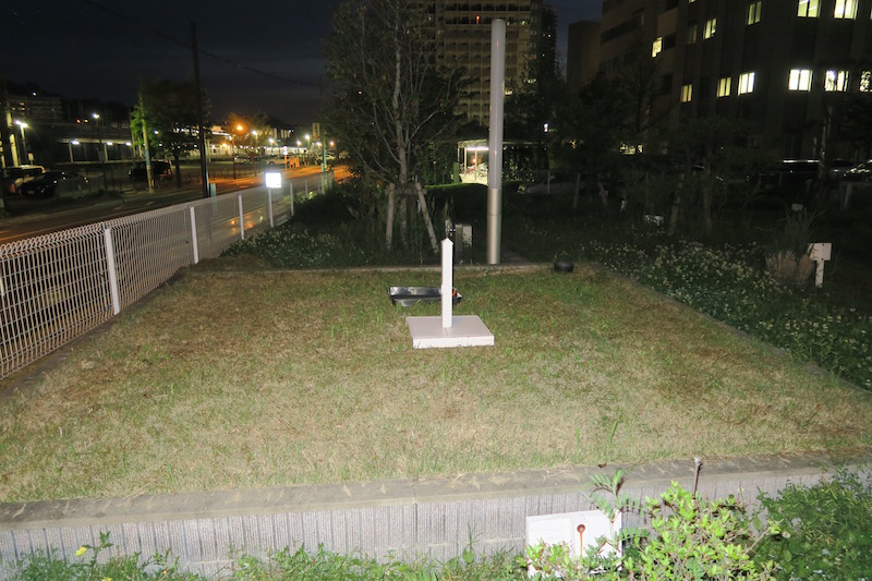
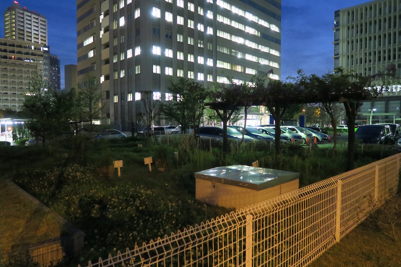
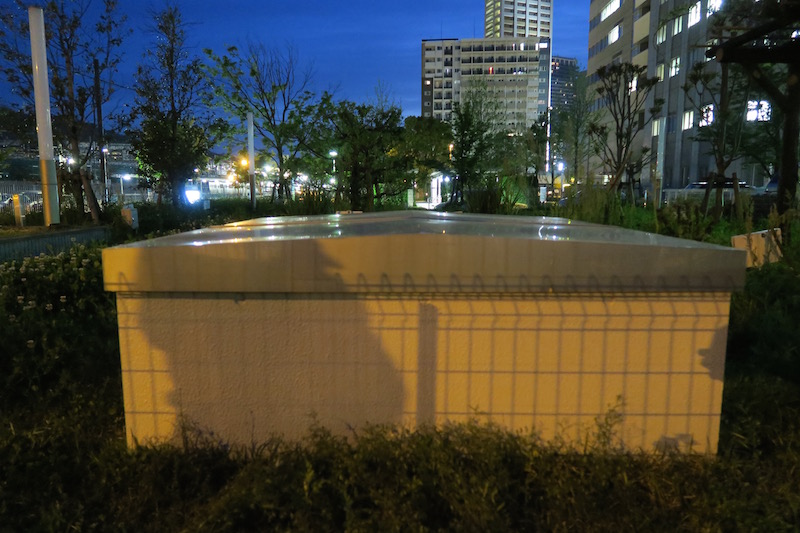
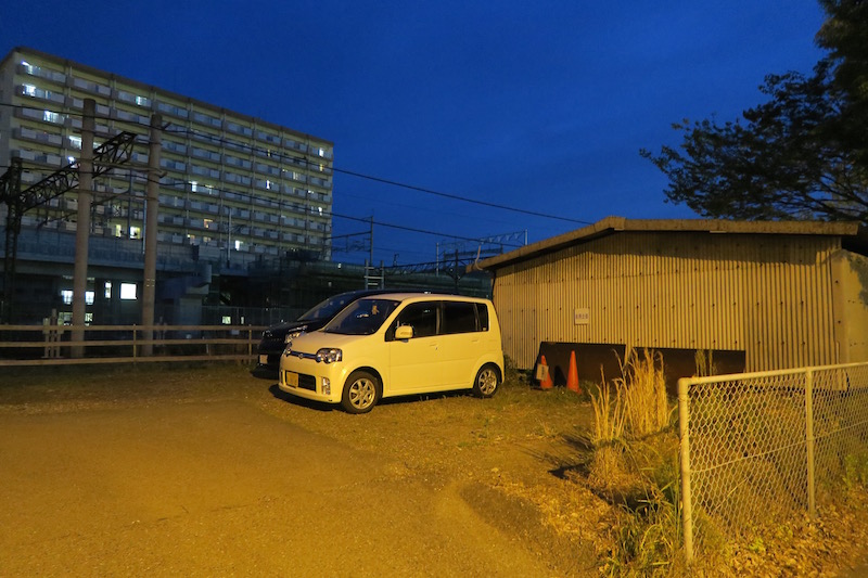
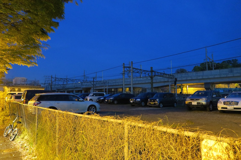
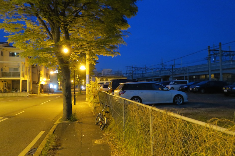
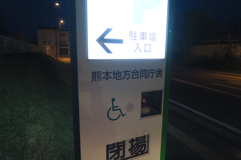
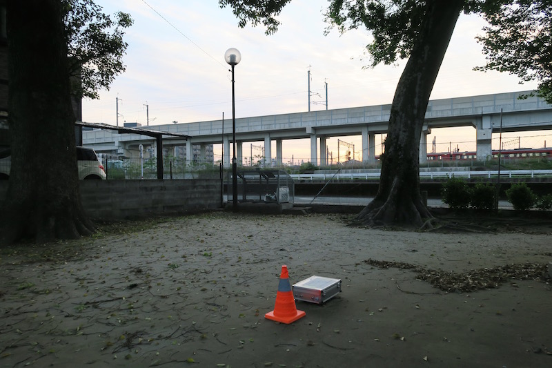
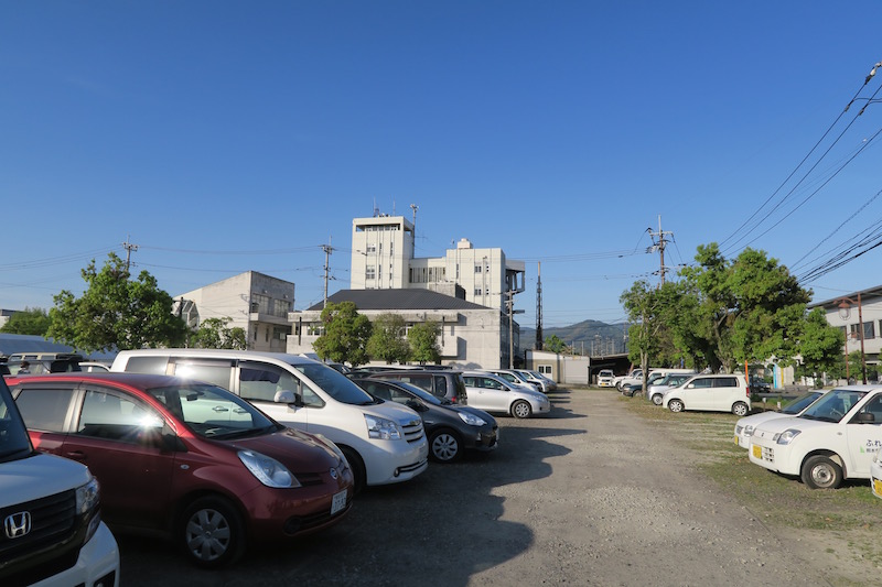
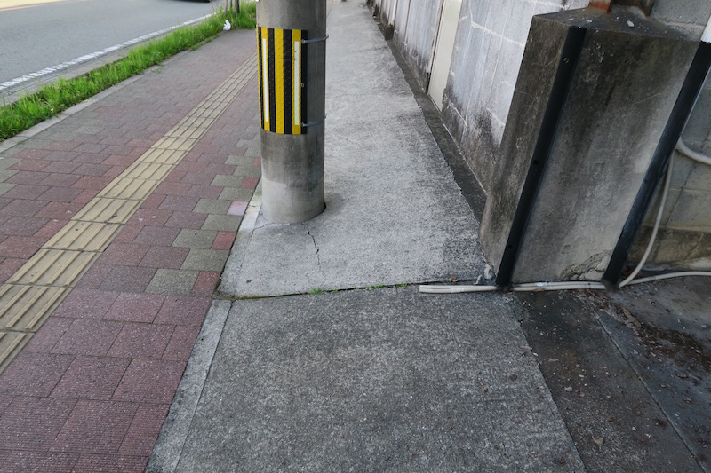
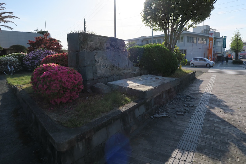
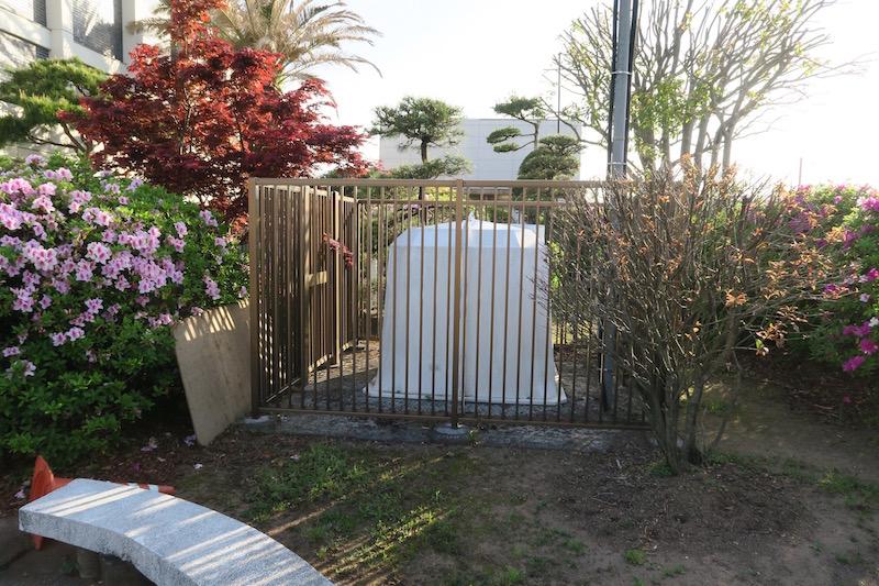
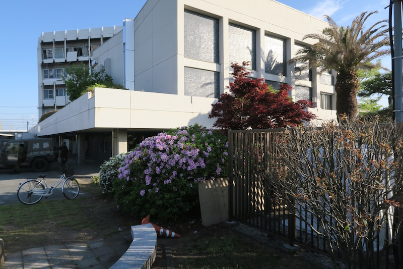
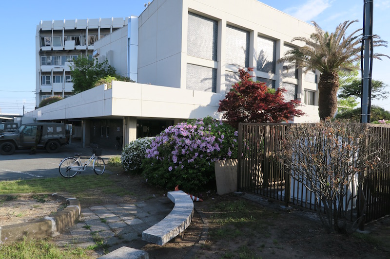
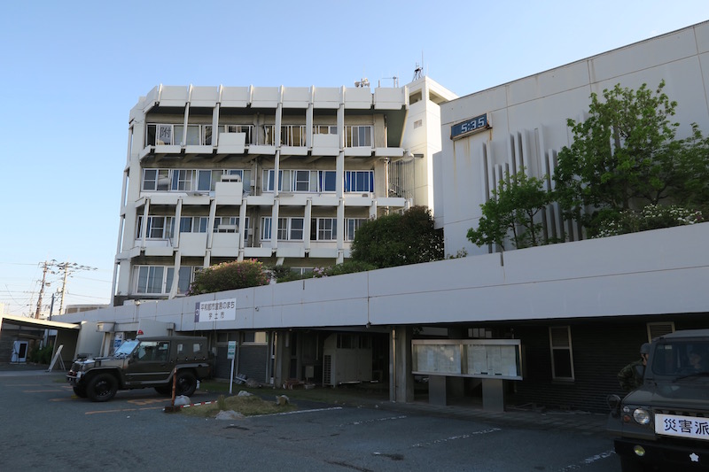
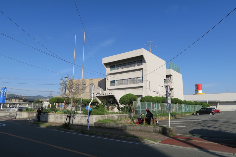
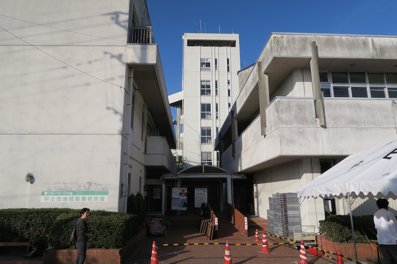
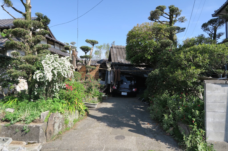
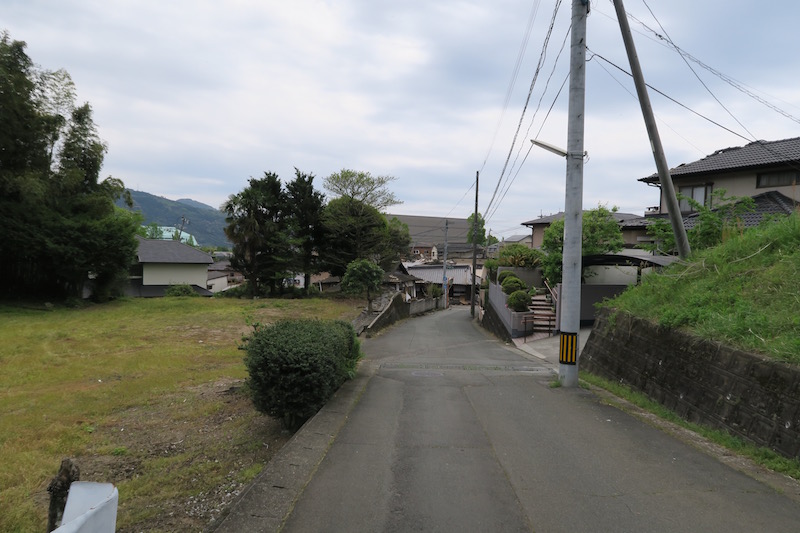
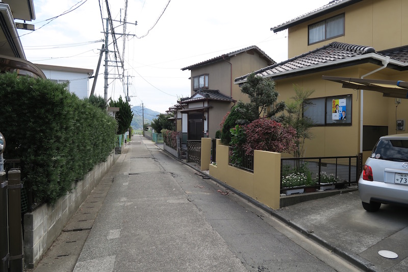
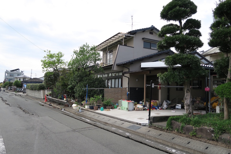
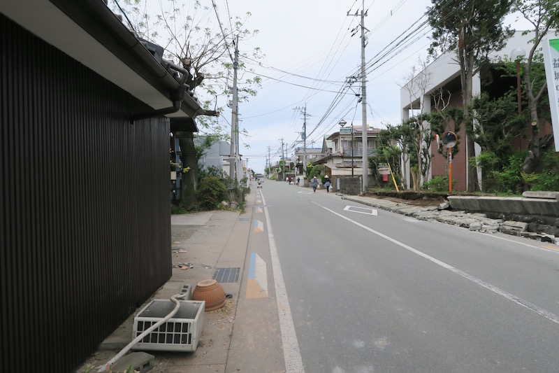
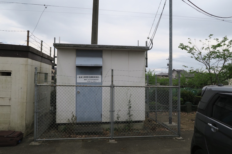
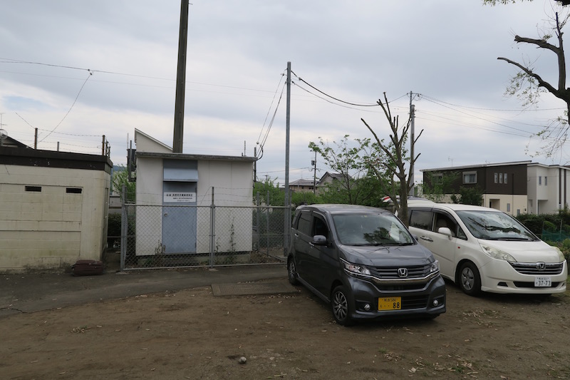
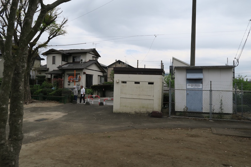
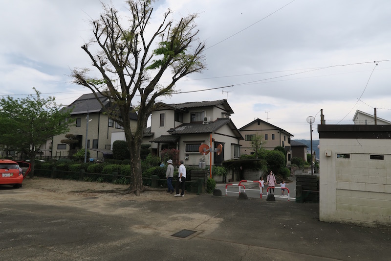
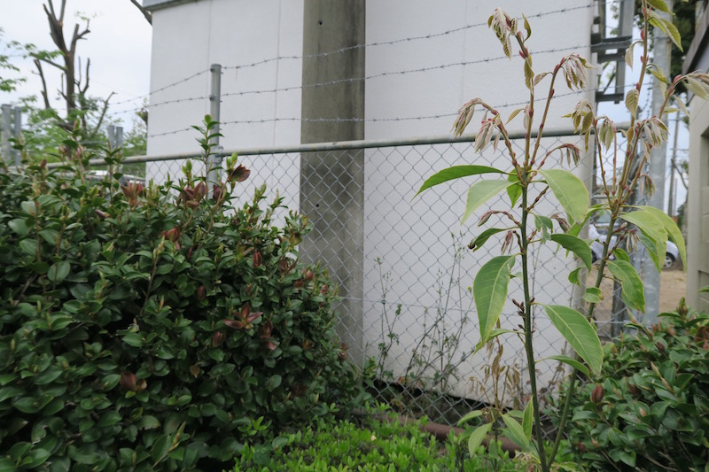
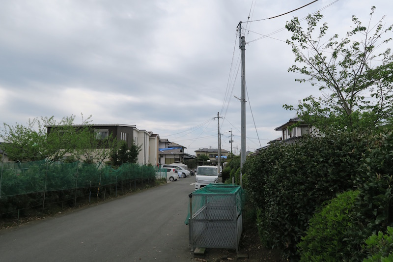
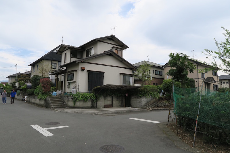
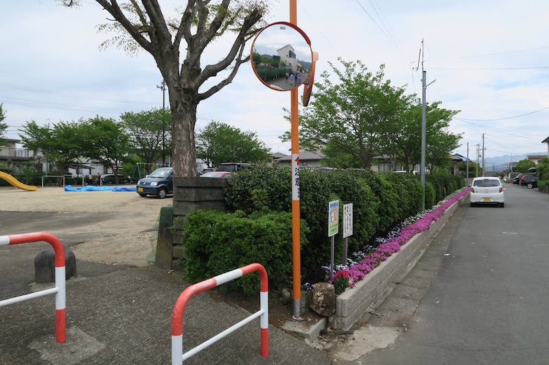
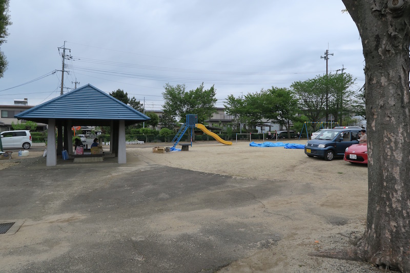
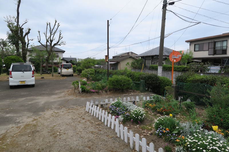
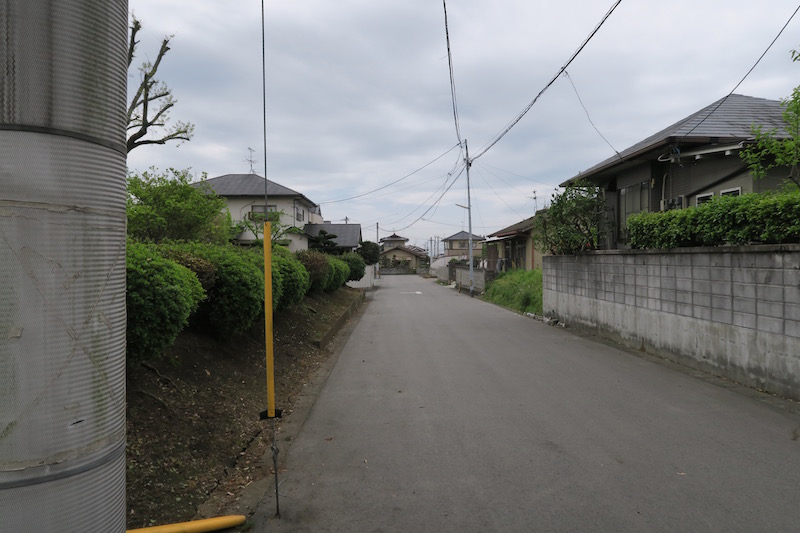
a. JMA Kumamoto station [Google Map]
JMA Kumamoto station is located around government building for Kumamoto area. Sensor may be settled on the small hill. I did not see serious damaged structures around the site.
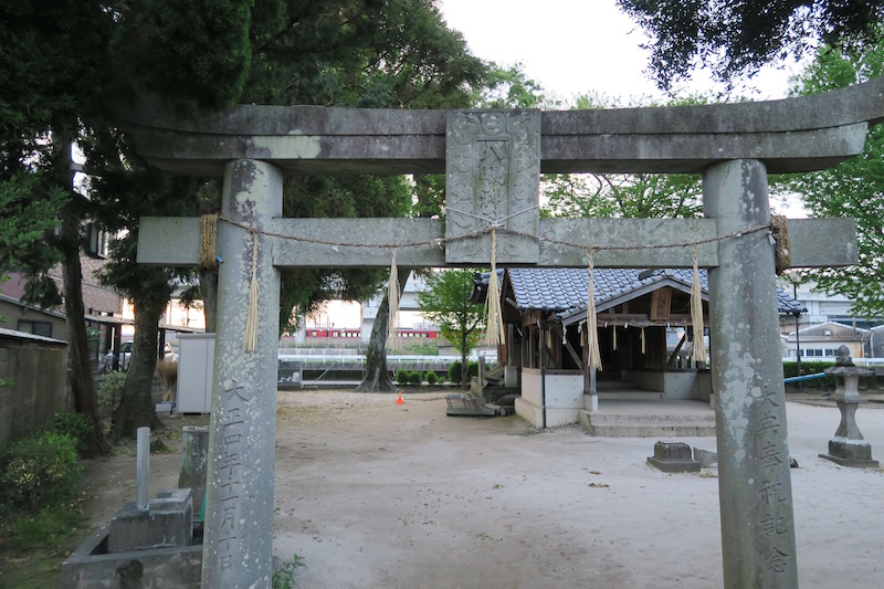
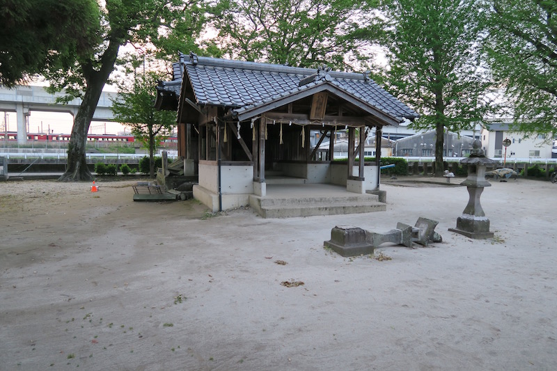
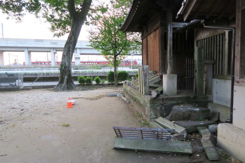
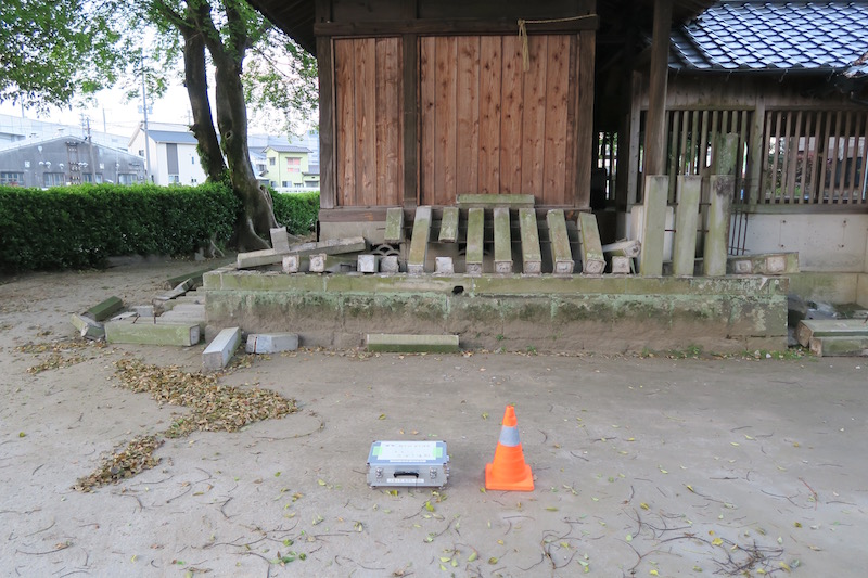
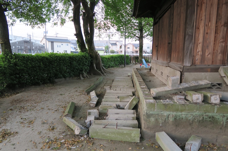
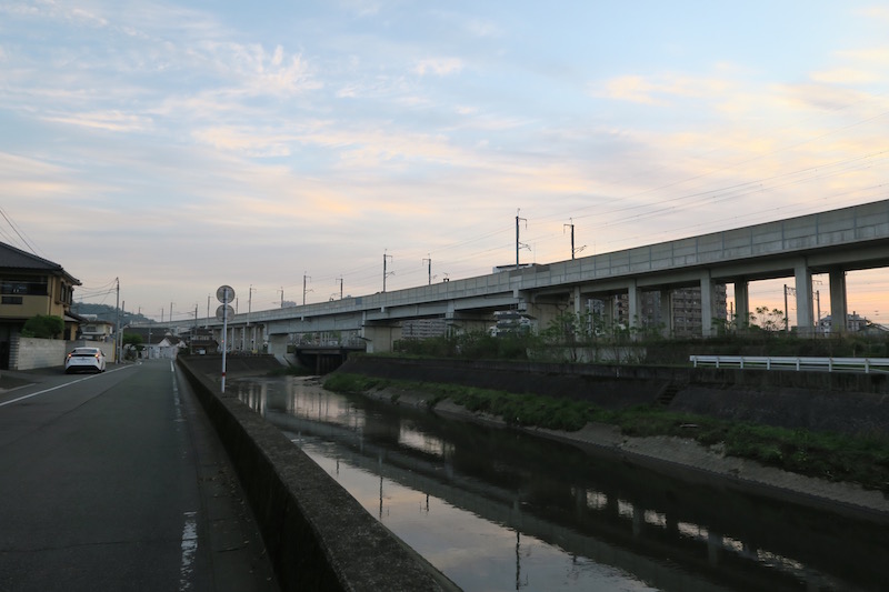
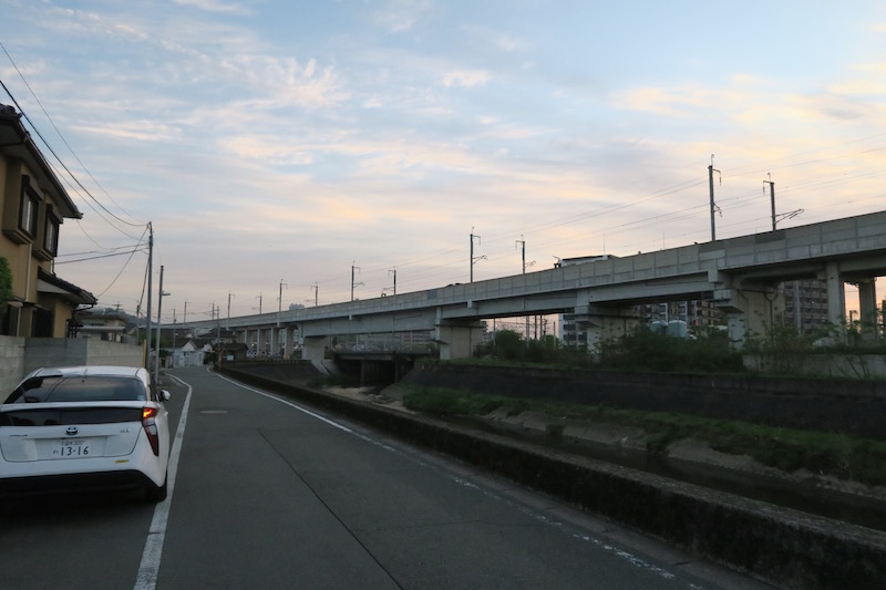
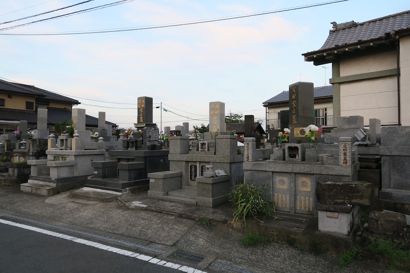
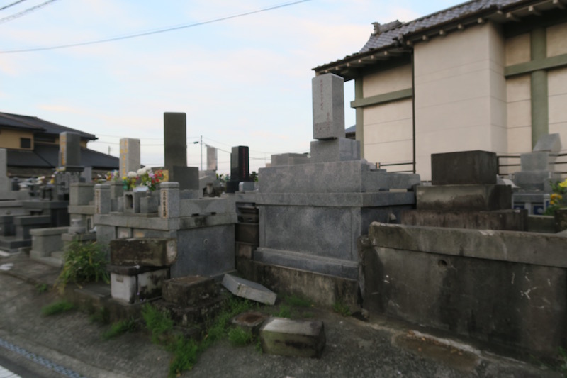
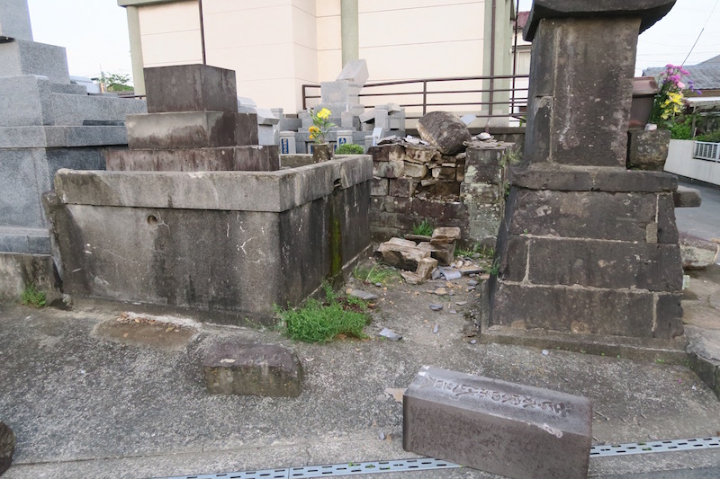
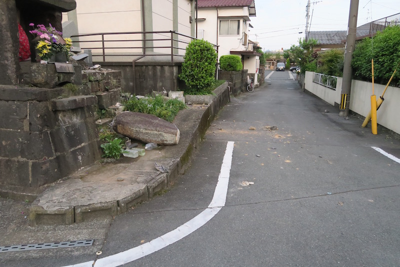
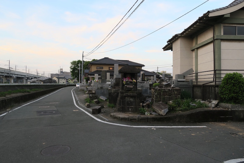
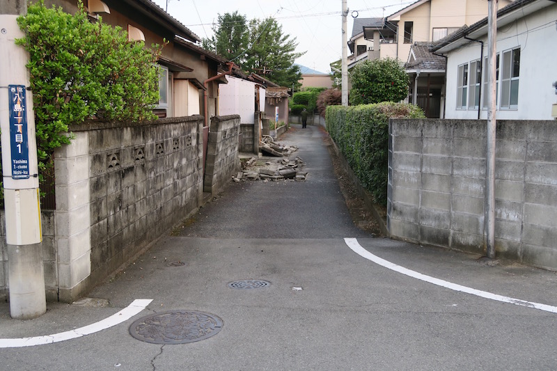
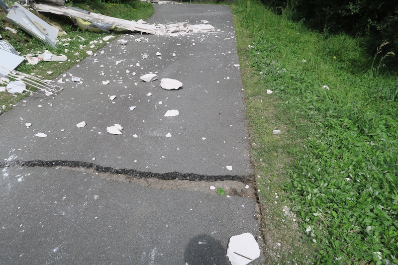
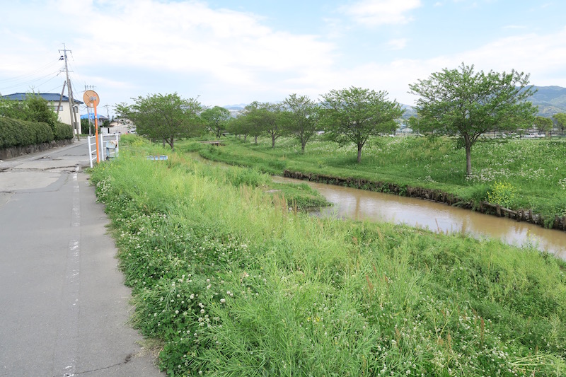
b. Derailment site of Kyushu Shinkan-sen [Google Map]
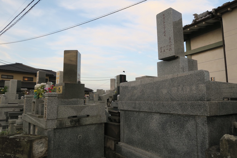
During the 1st event, Kyushu Shinkan-sen was derailed around Kumamoto station. Stone lanterns in Yashima shrine closed to the derailment site were collapsed. According to the residents, the damages occurred during the 1st event. The other damages, open cracks on road, significant damage of gravestones, etc., occurred during the 2nd event.
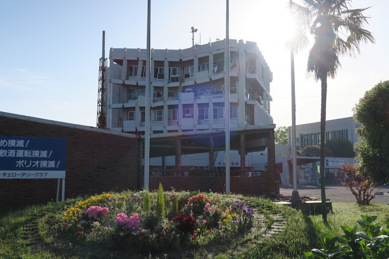
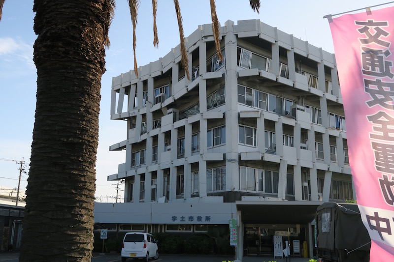
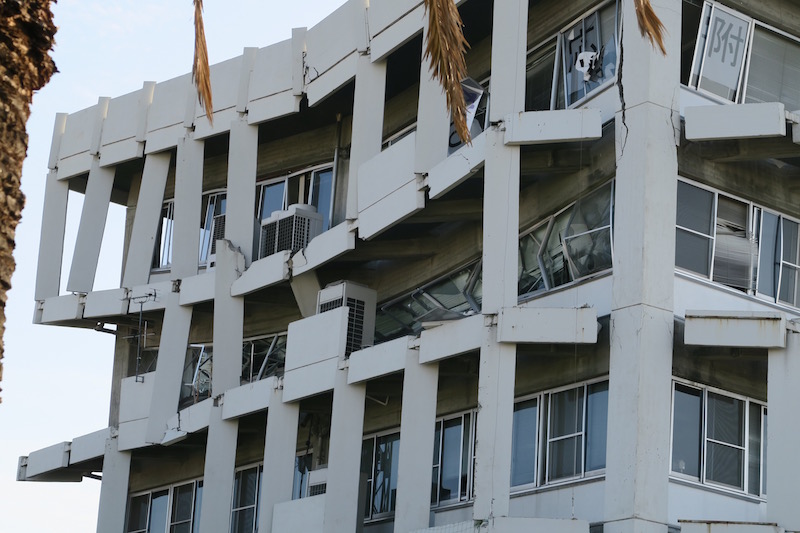
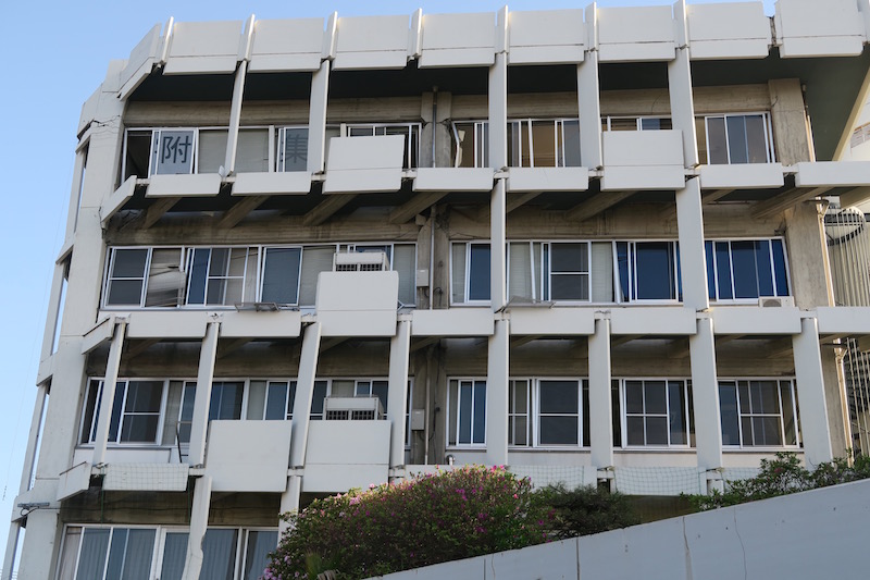
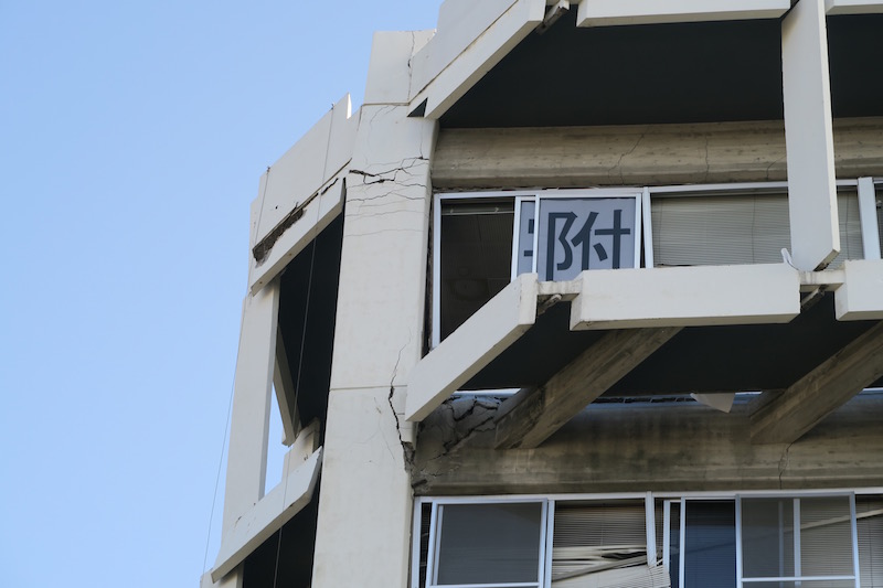
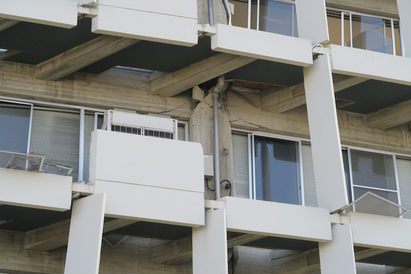
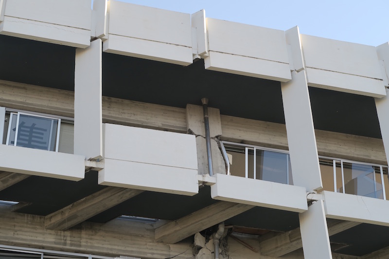
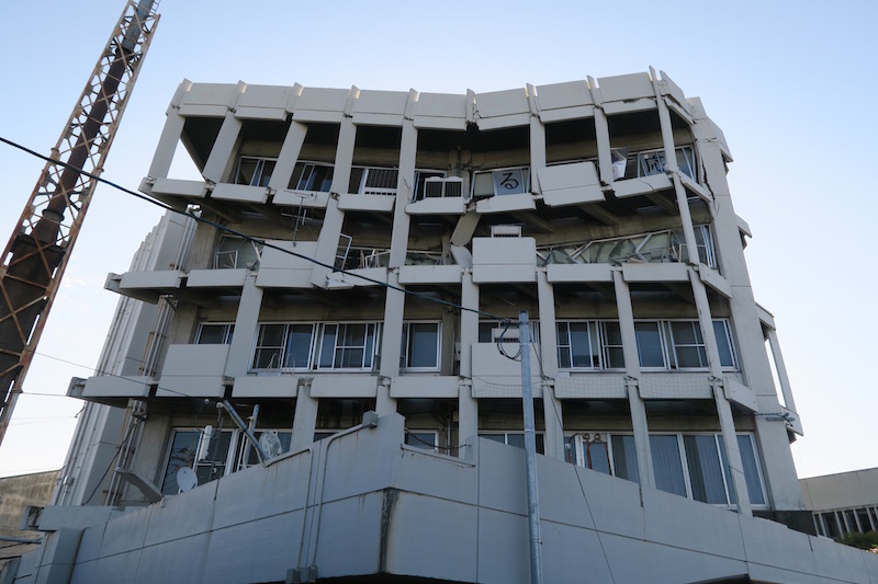
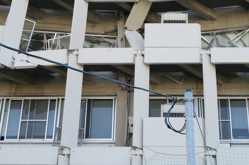
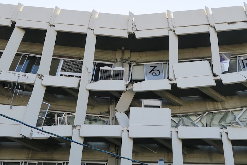
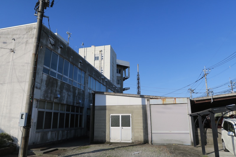
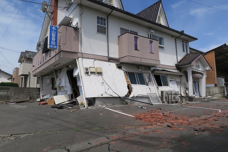
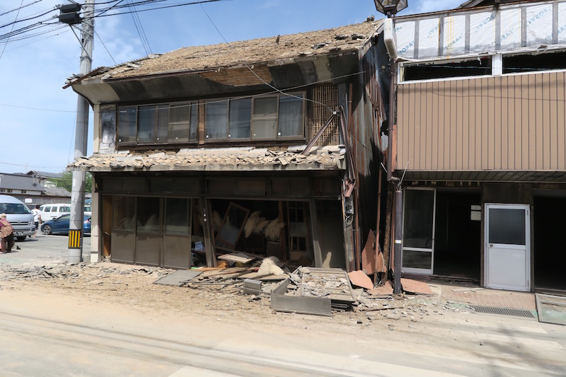
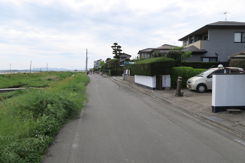
c. Uto city hall (K-NET MM008) [Google Map]
4th and 5th floors of city hall (RC structure) in Uto city were collapsed. Shear failures of pillar were recognized at the connection to beam. This damage was caused by 2nd event. K-NET KMM008 station is located in the same ground (PGA=882cm/s/s and PGV=85cm/s). Peak period of pseudo velocity response spectrum is 0.71s.

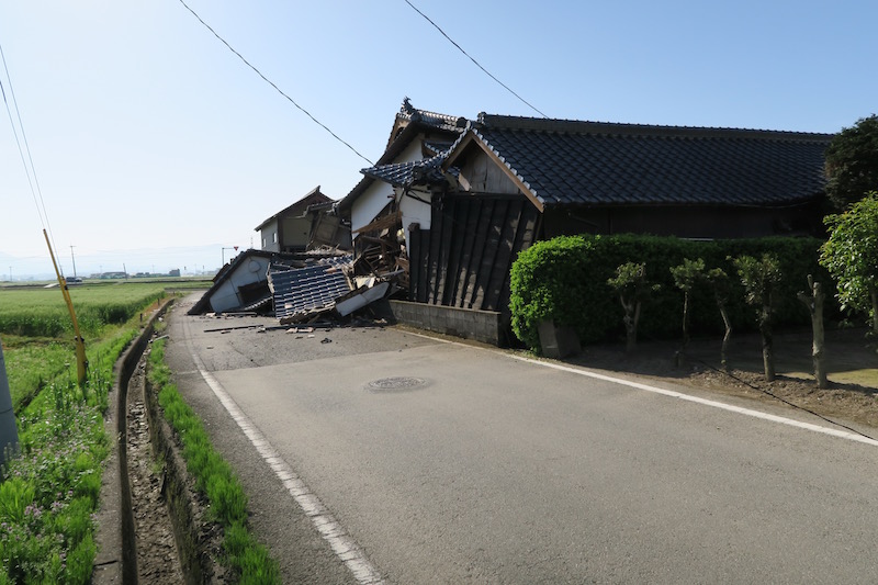
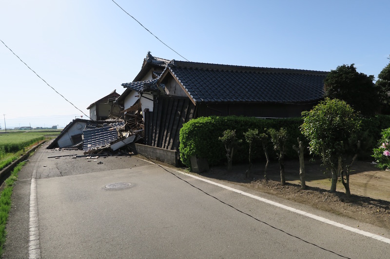
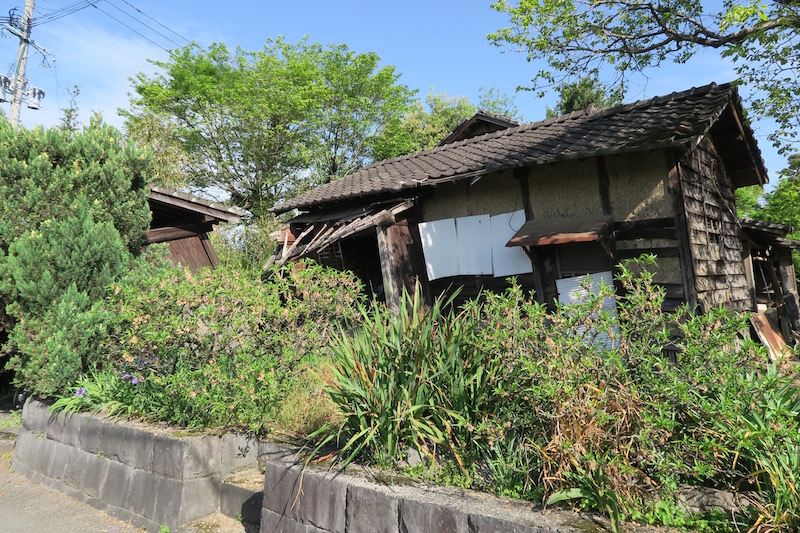
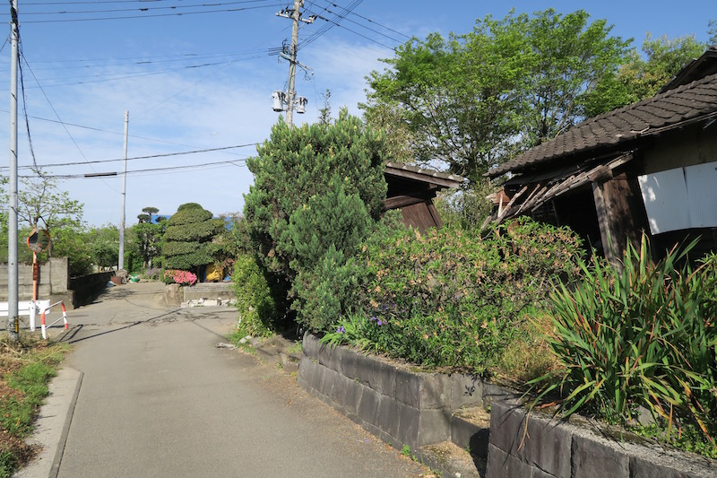
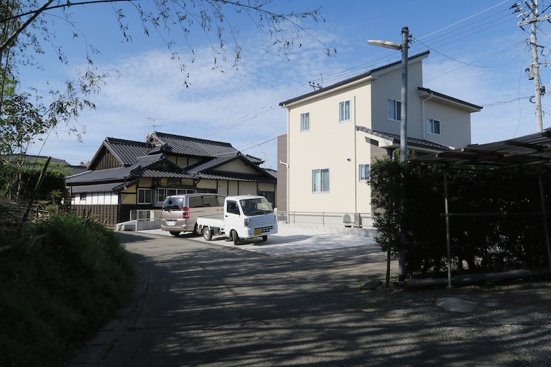
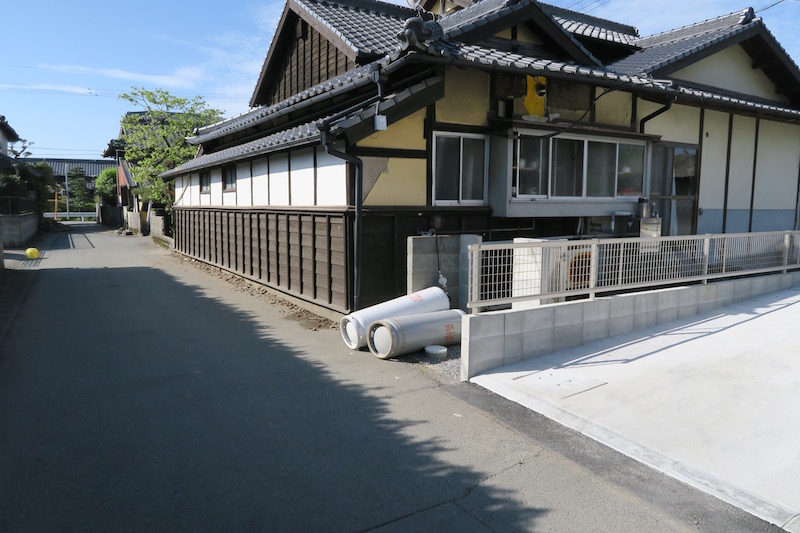
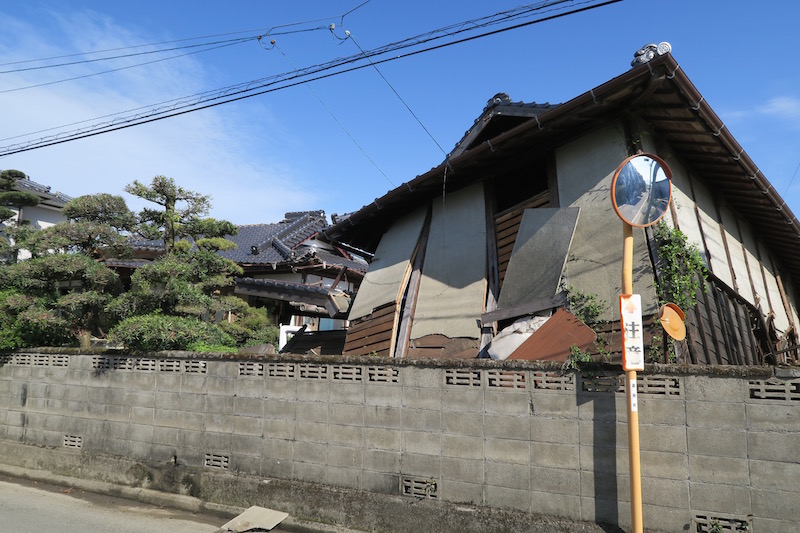
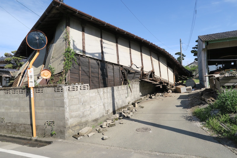
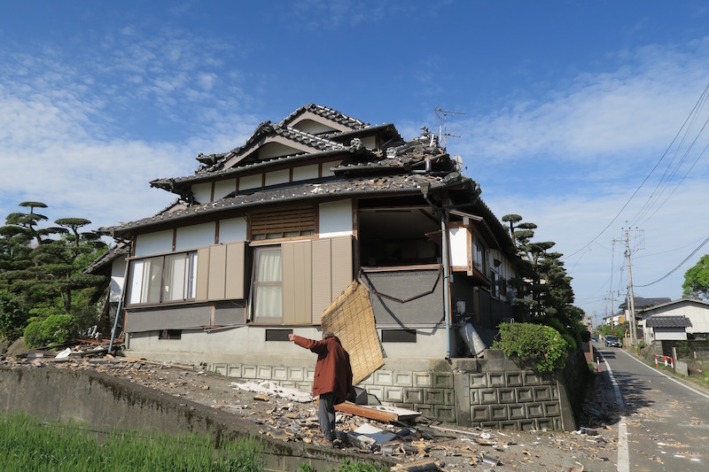
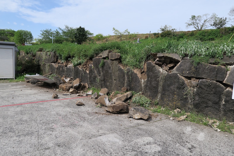
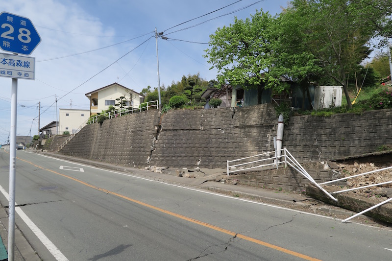
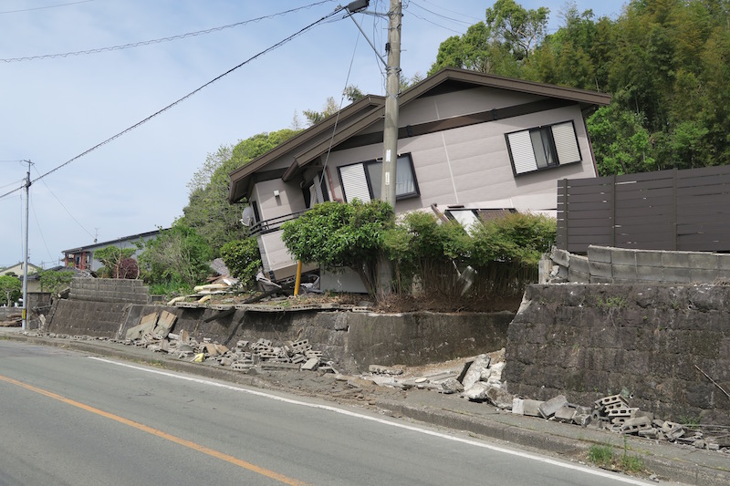
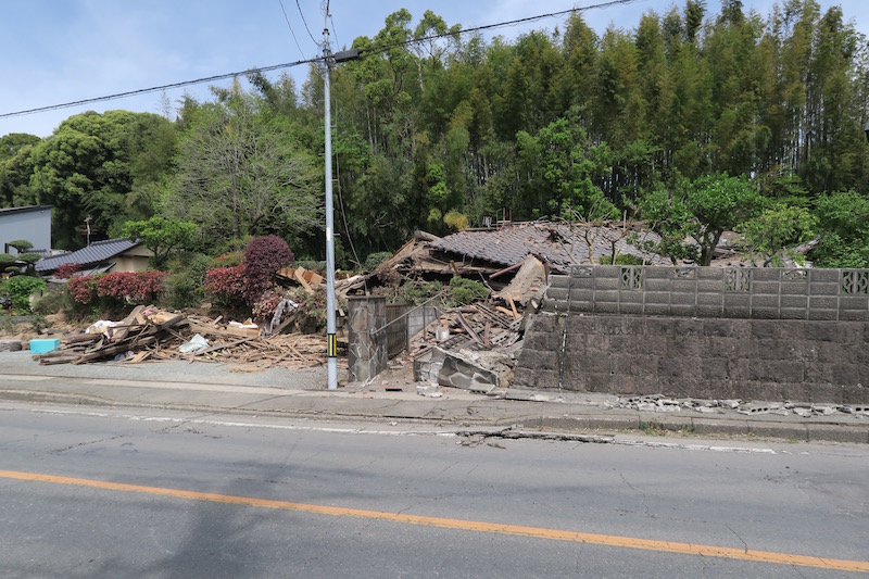
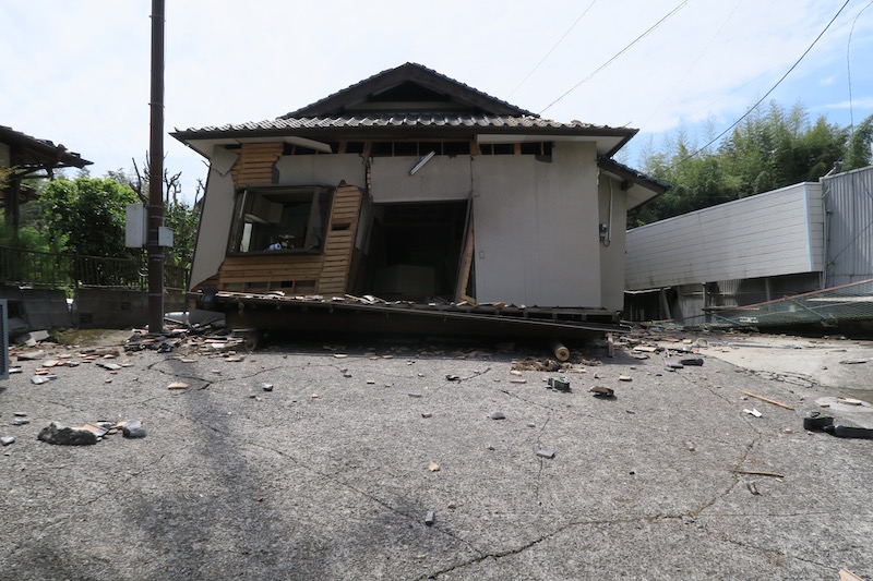
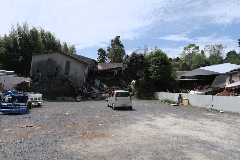
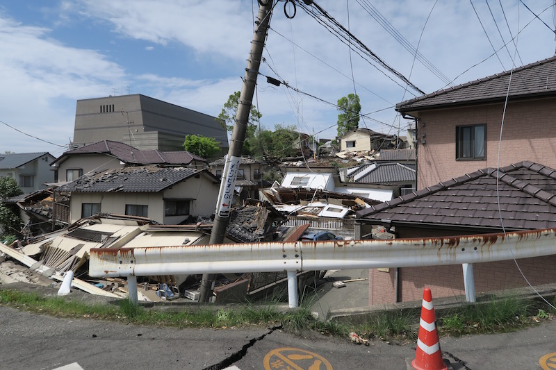
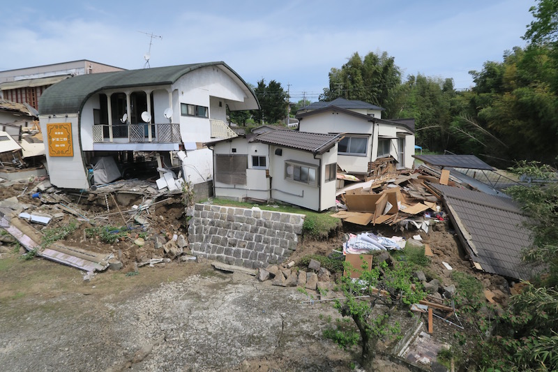
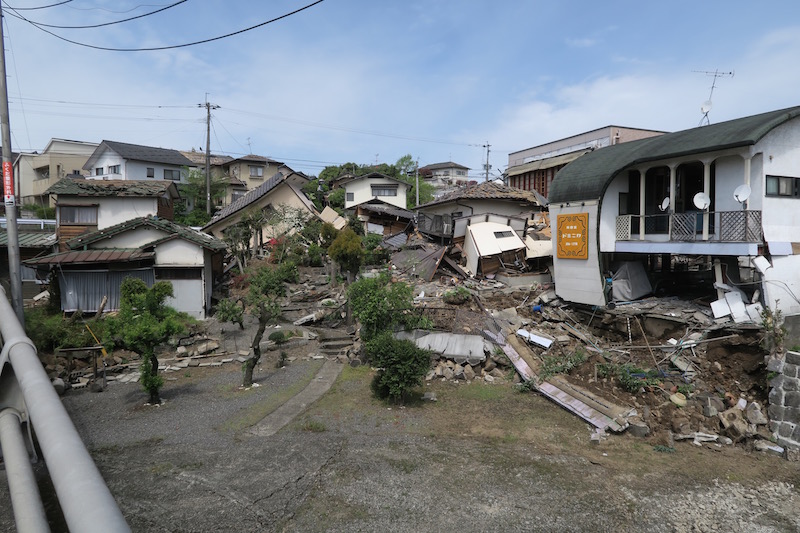
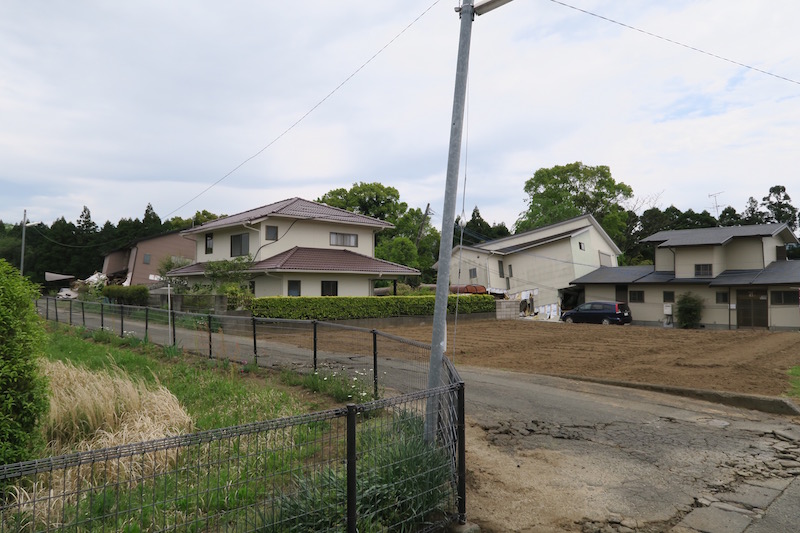
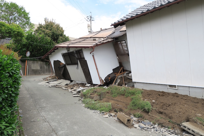
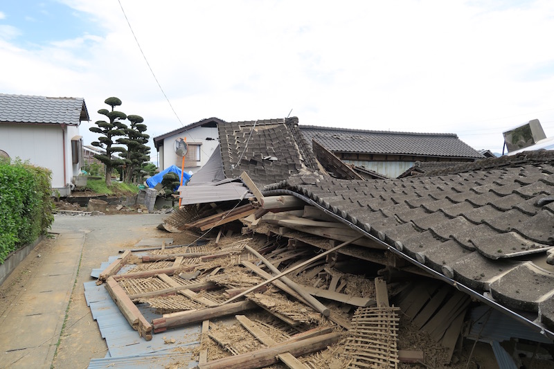
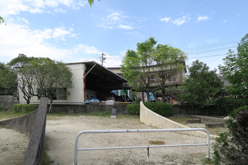
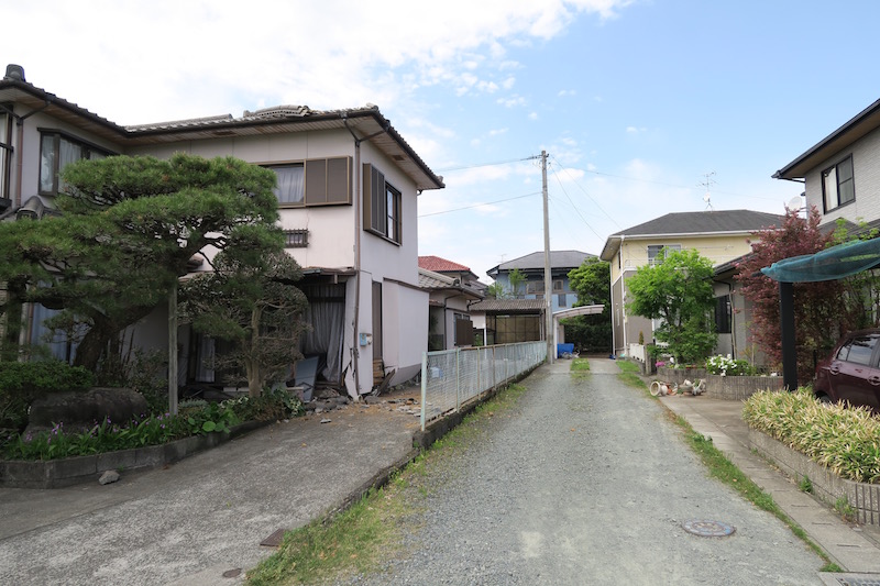
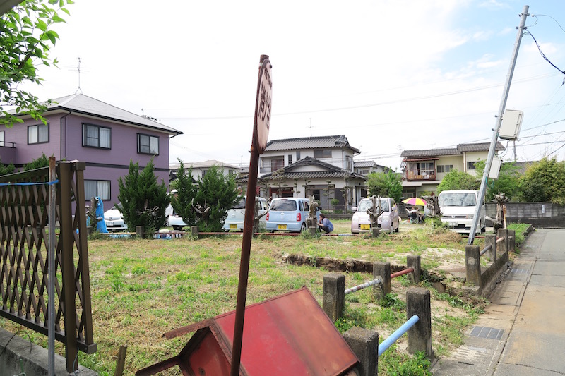
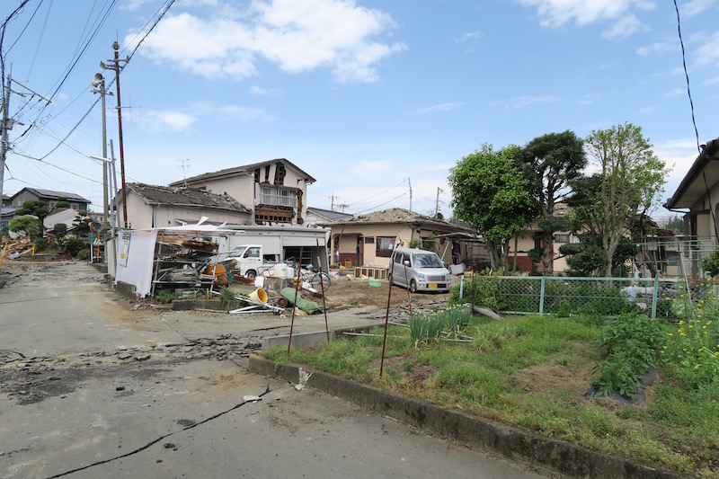
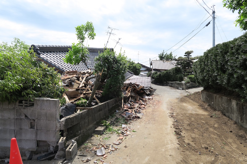
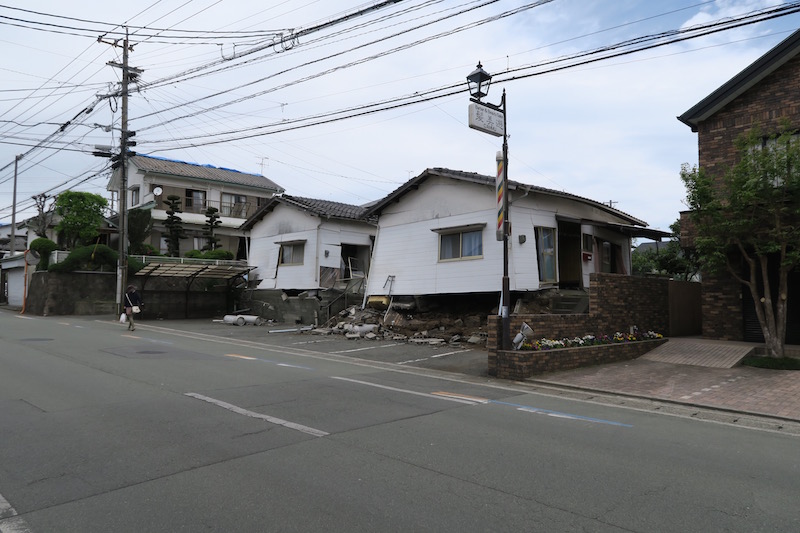
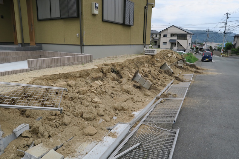
d. Kashima town [Google Map]
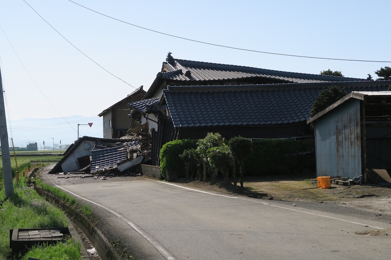
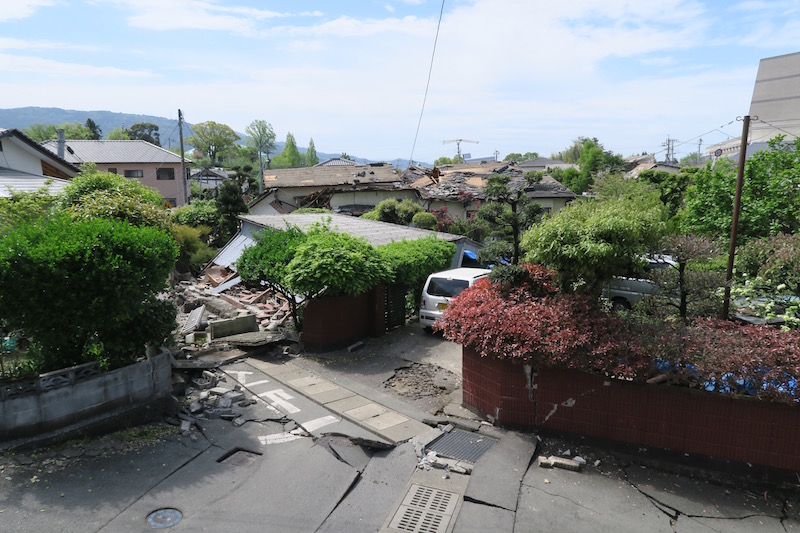
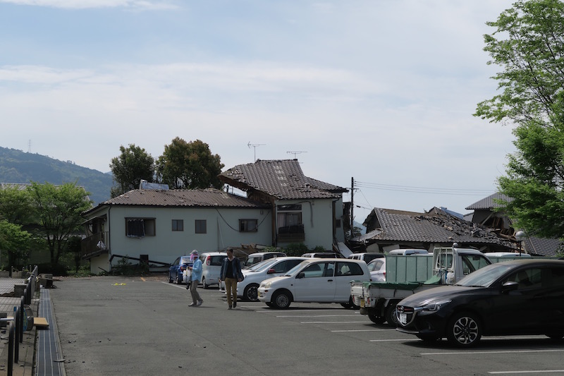
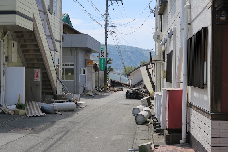
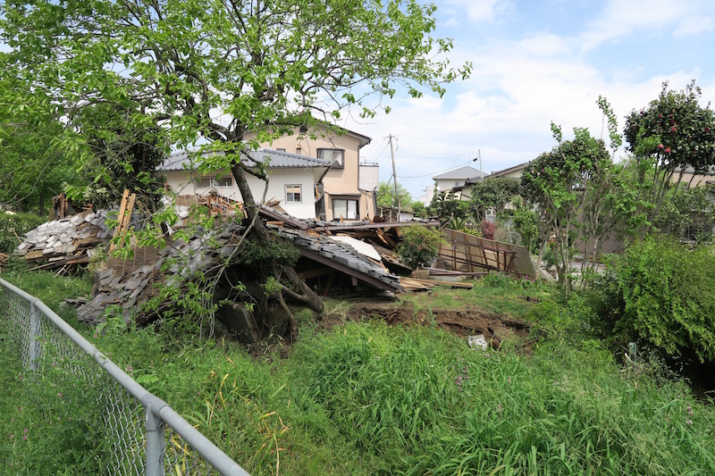
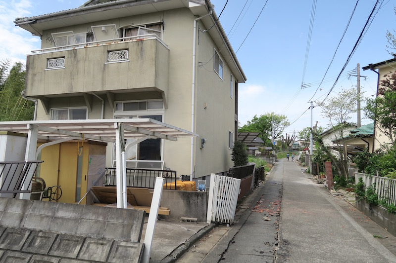
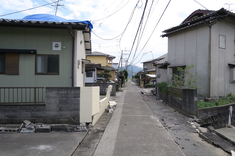
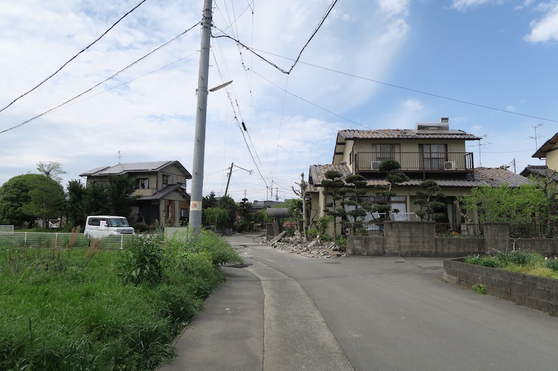
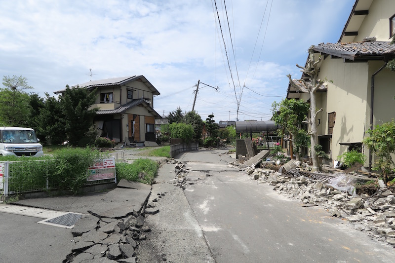
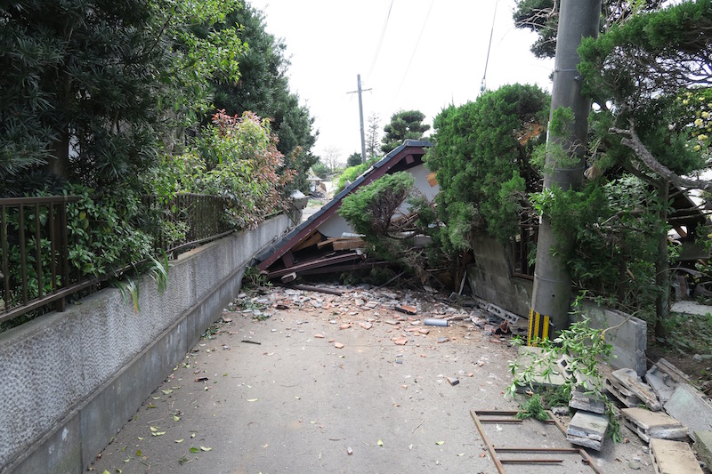
Collapse of residential houses occurred more than one village in Kashima town. In Namazu village, where we visited, severe damages were concentrated on wooden houses with lower seismic performances. According to the resident, some roof tiles were damaged during the 1st event, whereas the other significant damages were caused by the 2nd event.
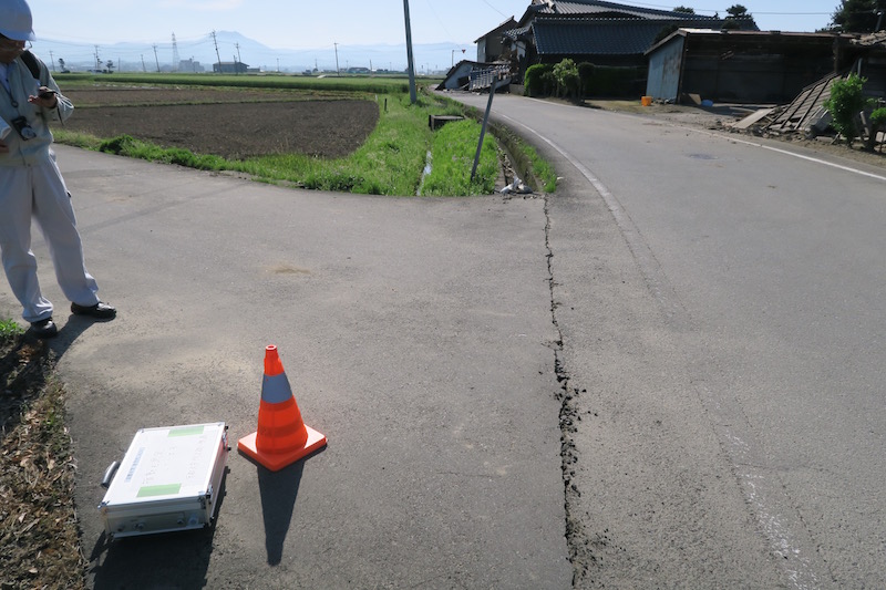
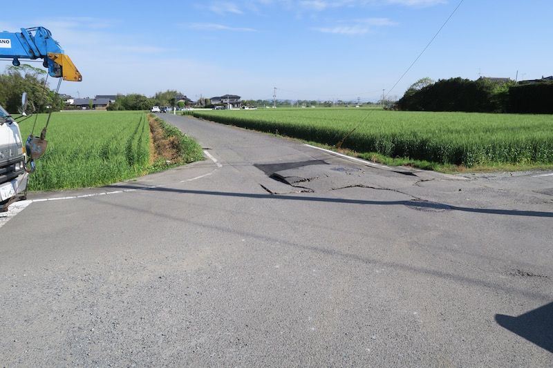

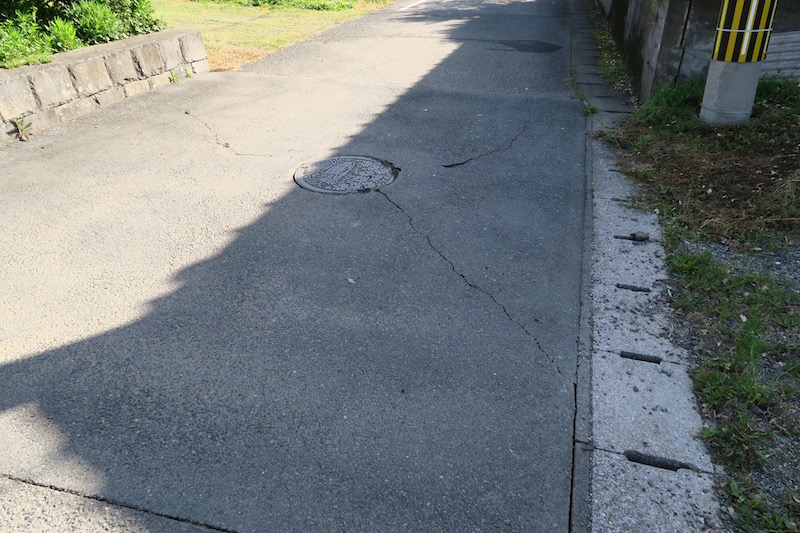
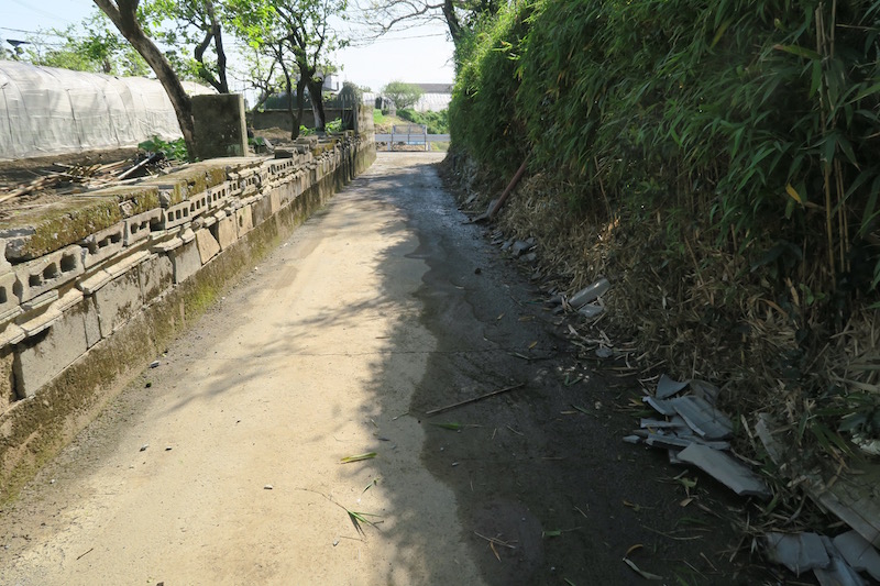
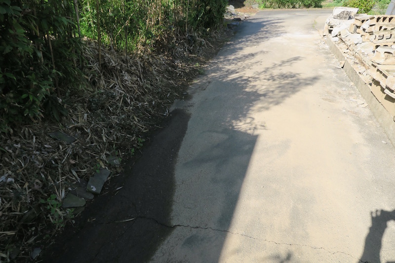
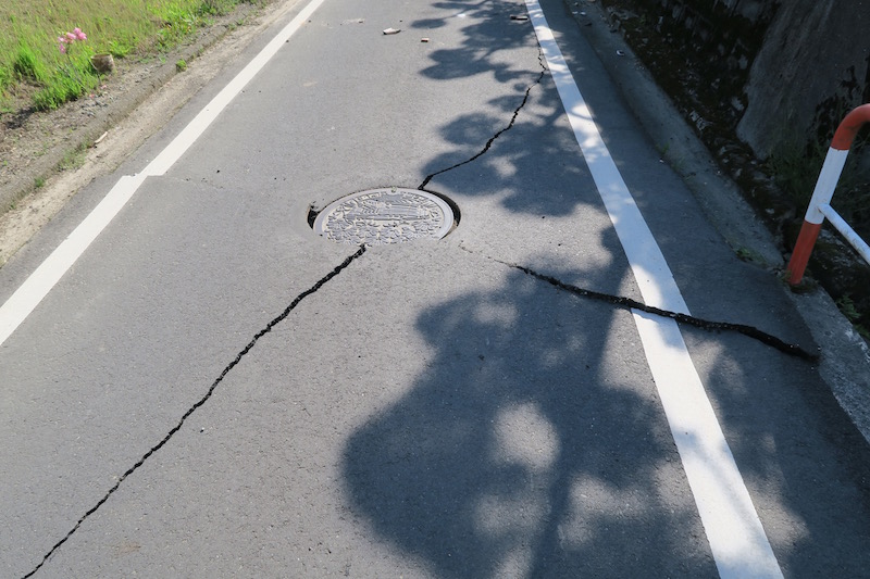
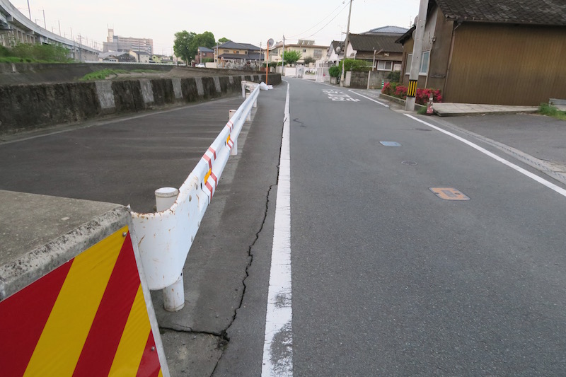
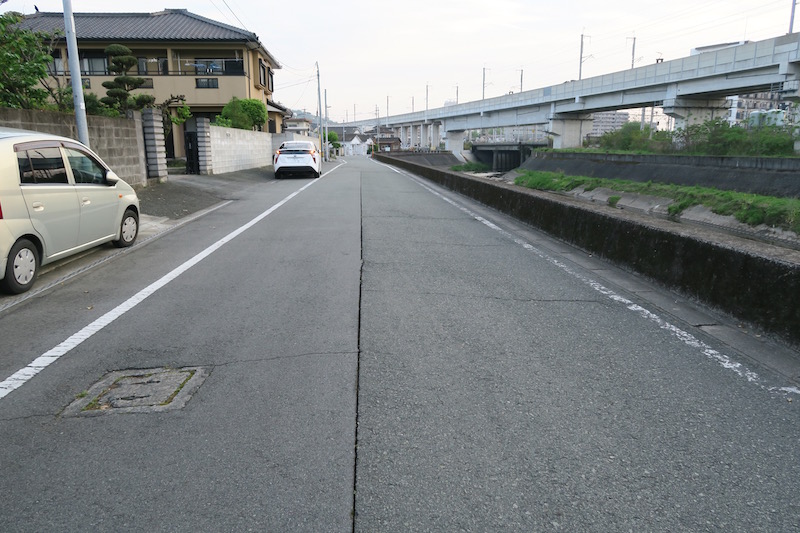
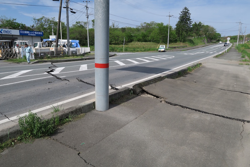
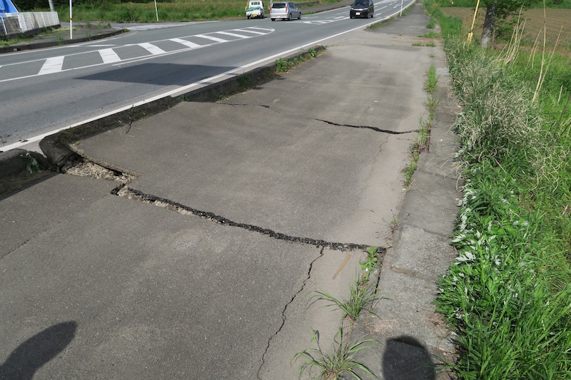
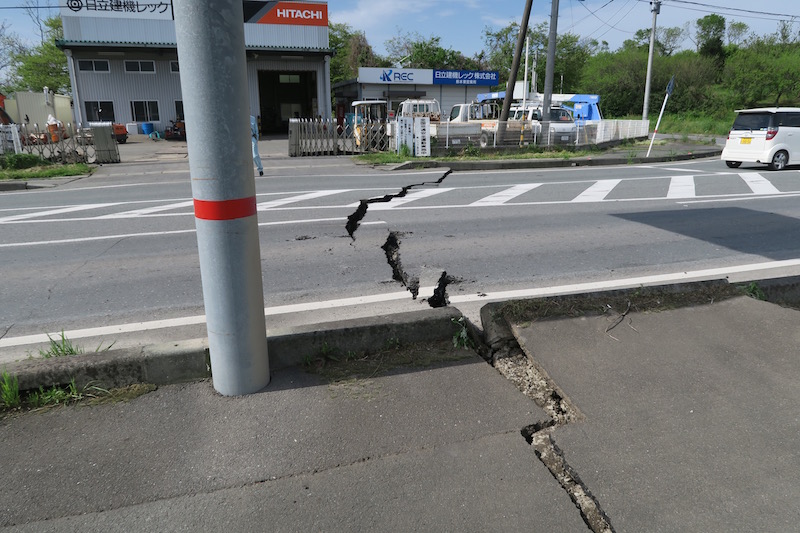
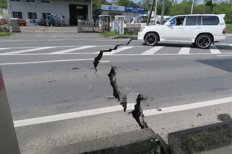
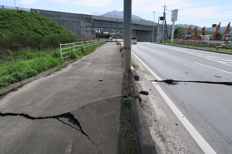
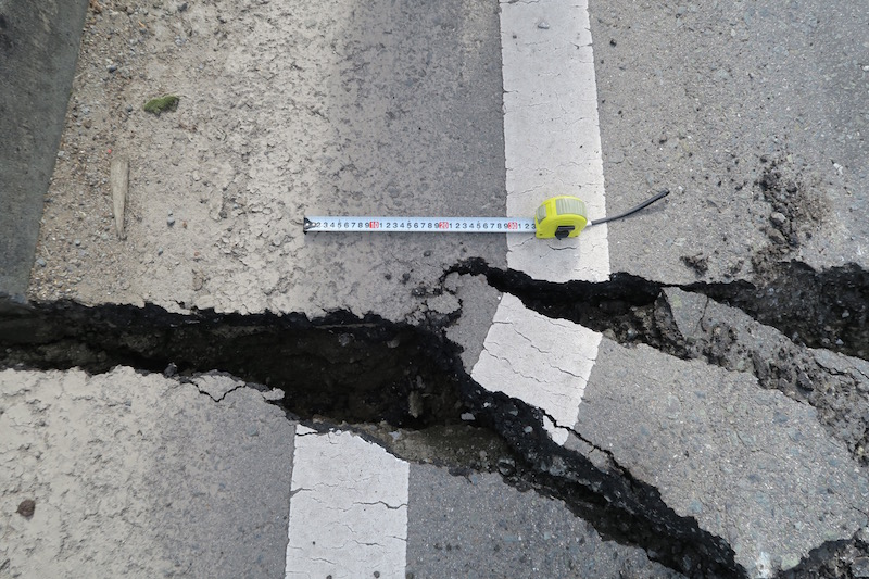
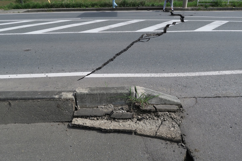
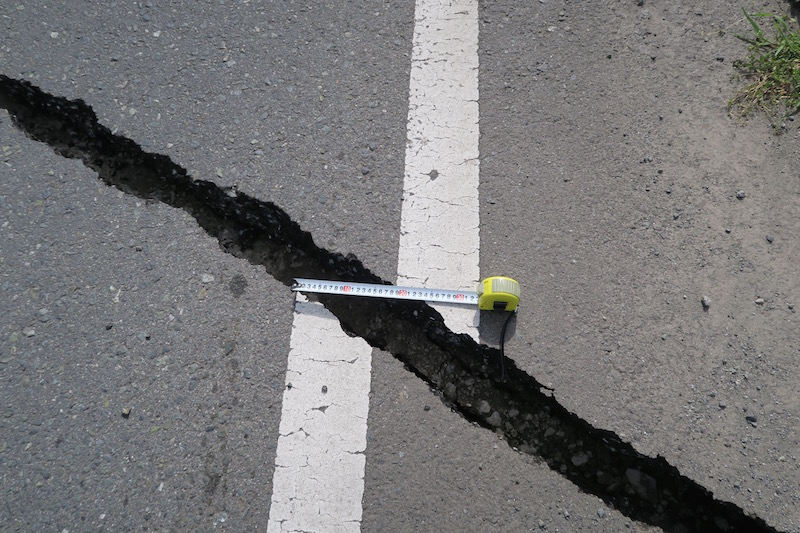
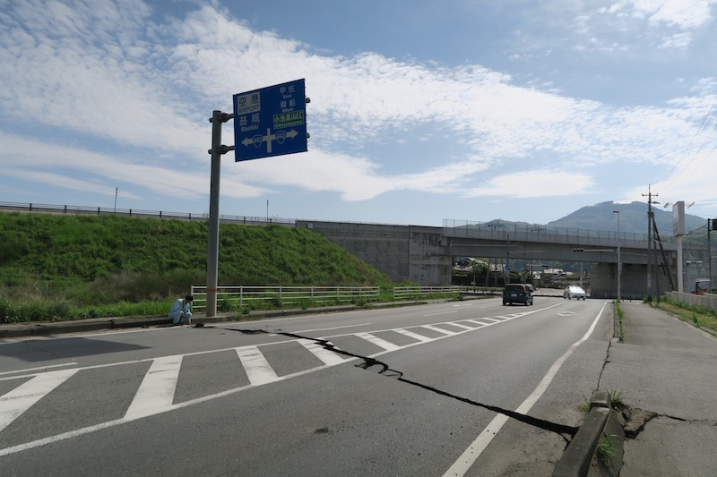
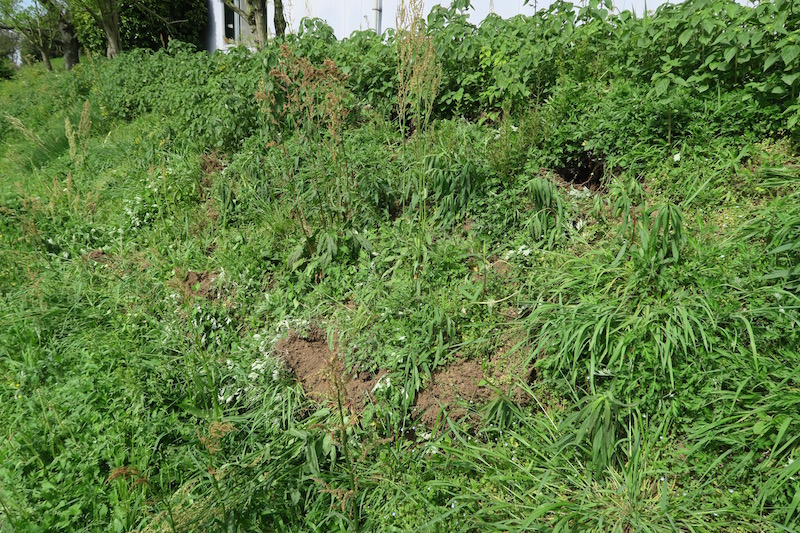
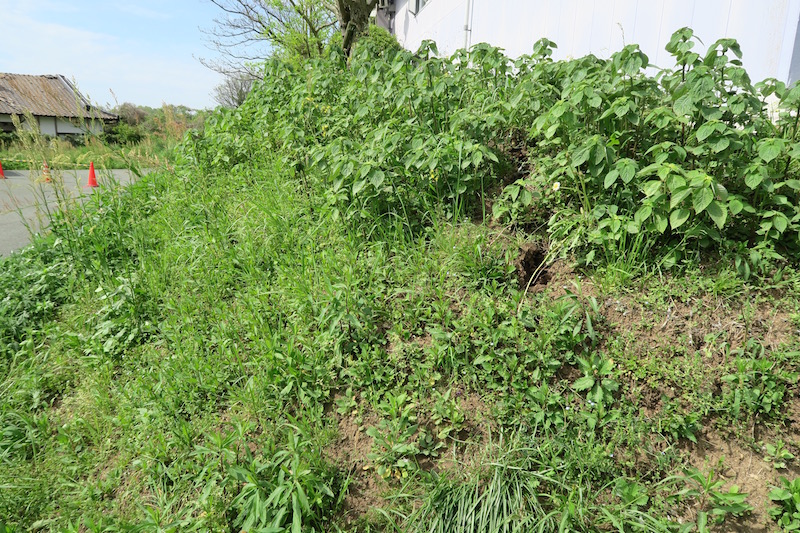
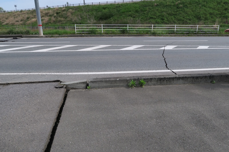
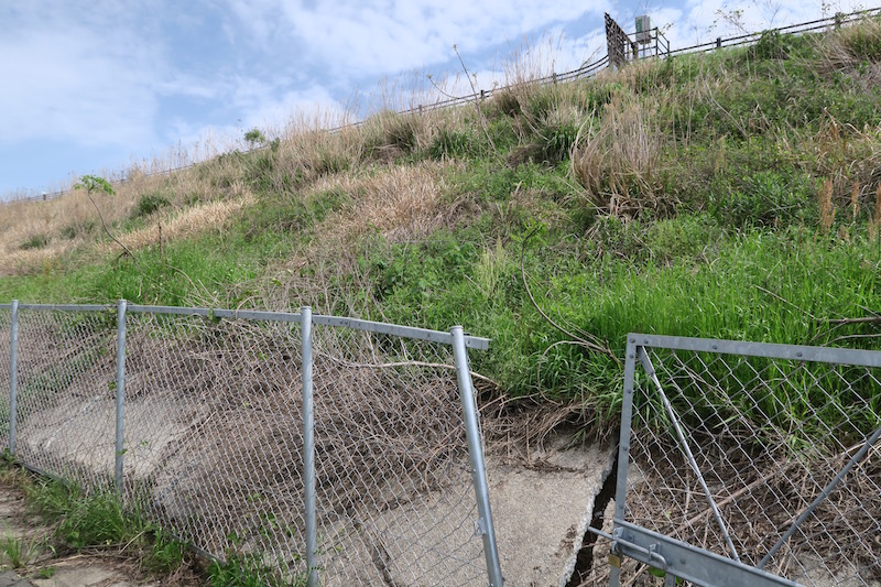
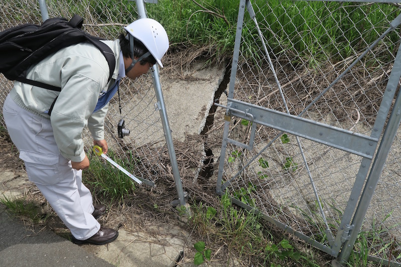
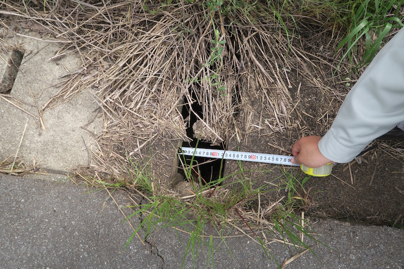
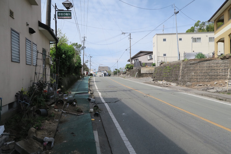
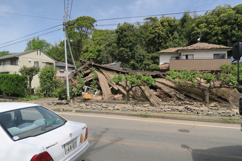
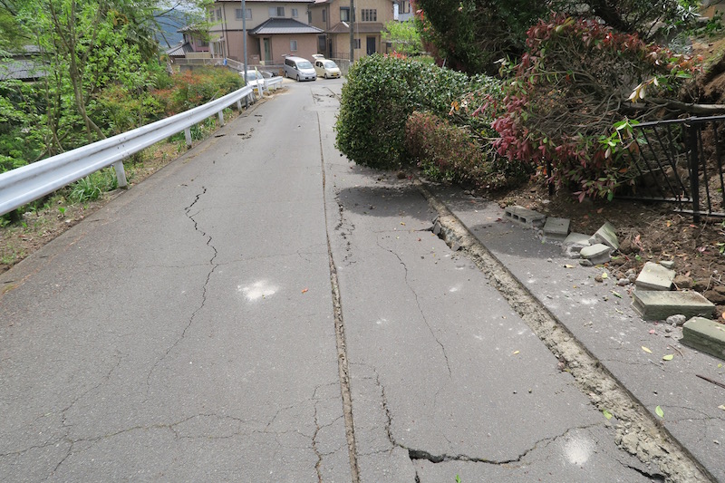
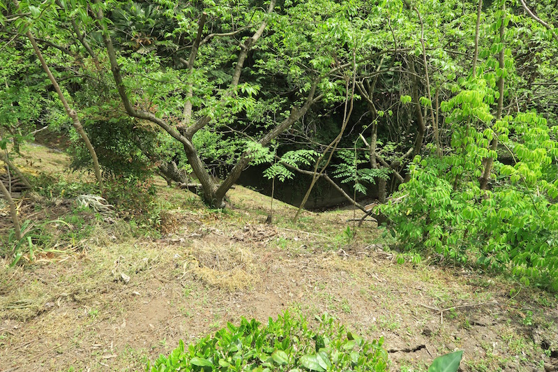
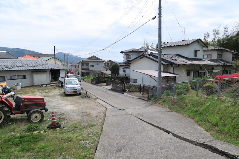
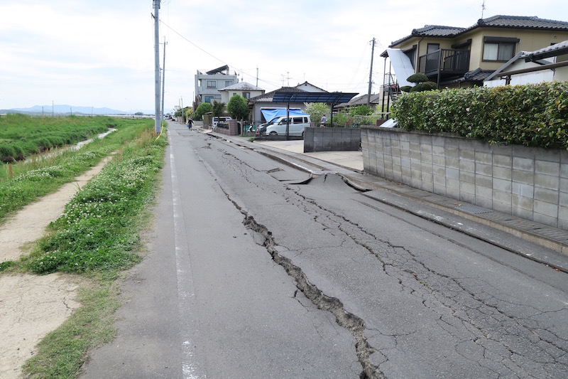
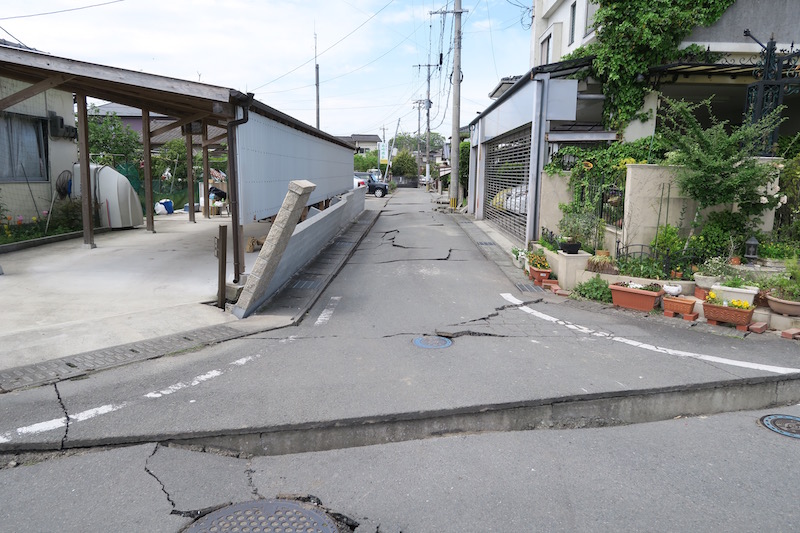
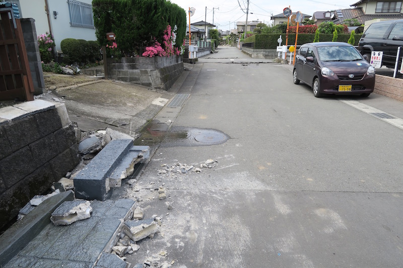
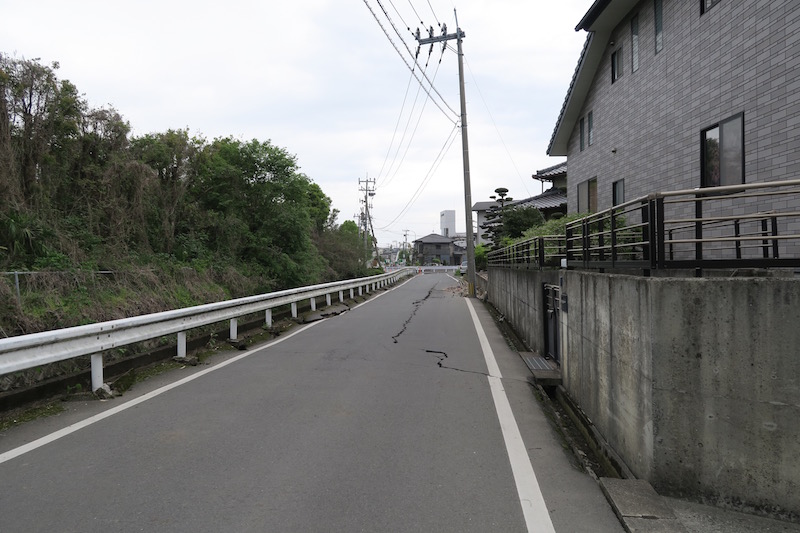
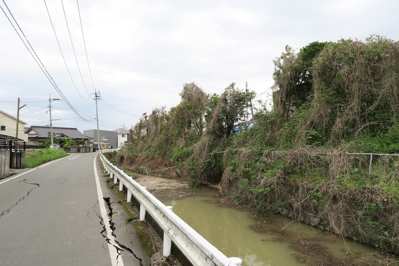
e. Surface faulting [Google Map]
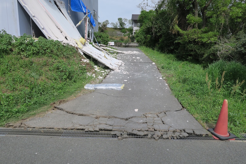
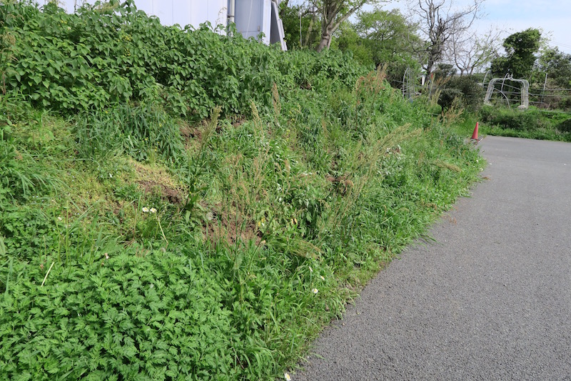
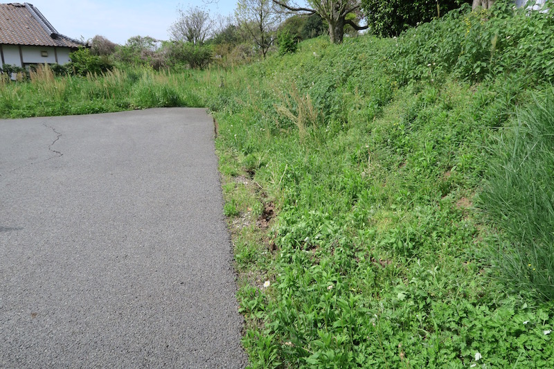
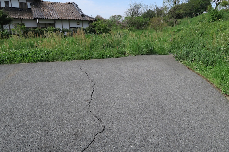
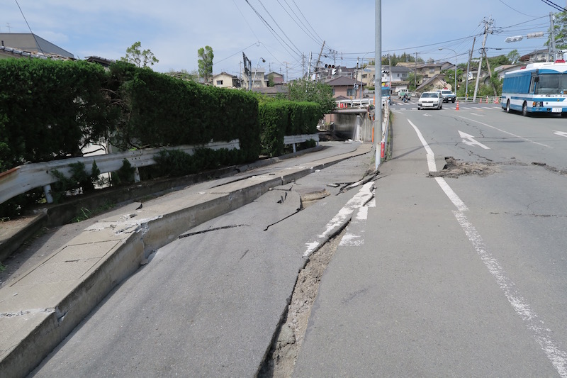
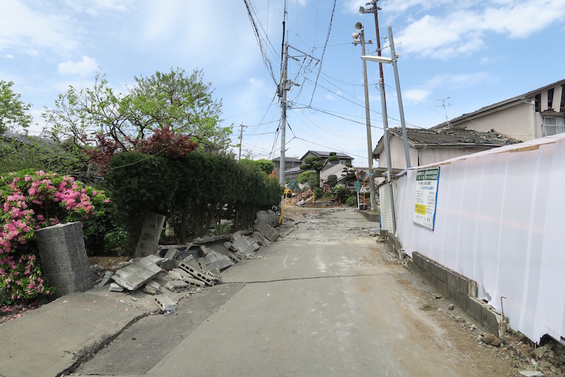
Right lateral dislocations cross the road way. The gap was approximately 30cm. The dislocation may be a part of surface faulting. This is because no landslides are expected in the area, the crack azimuth agrees with the fault strike, and its location is almost on the fault surface. According to the neighbor, the dislocation slightly appeared after the 1st event, and it grows to the current size after the 2nd event.
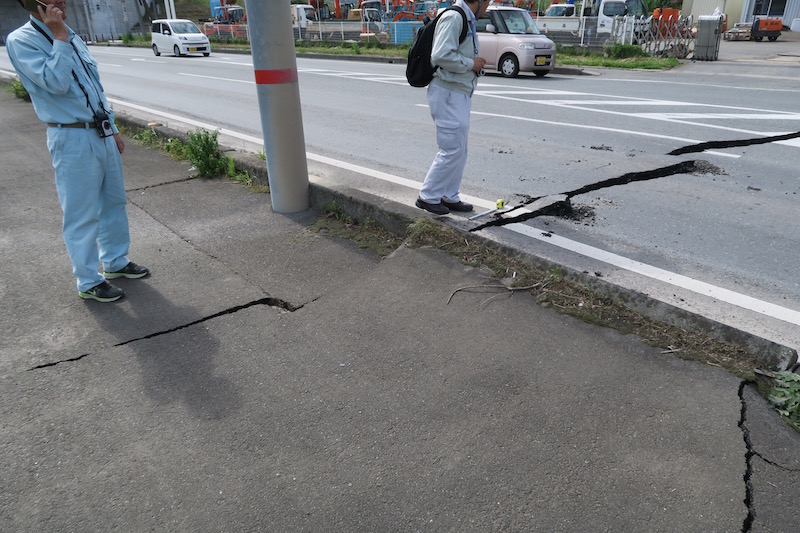

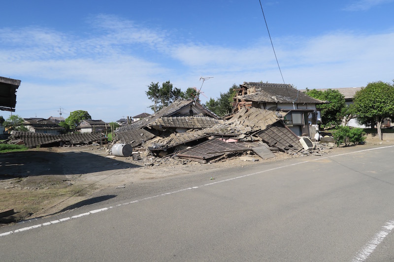
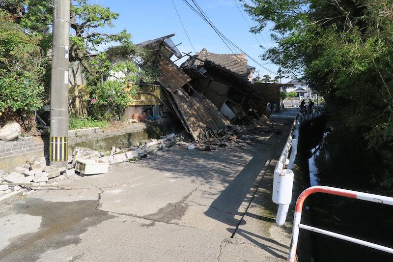
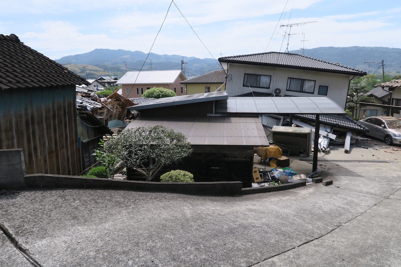
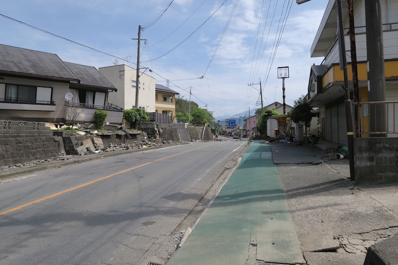
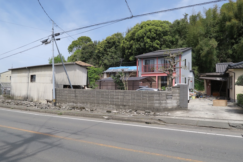
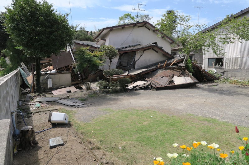
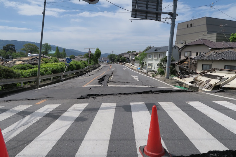
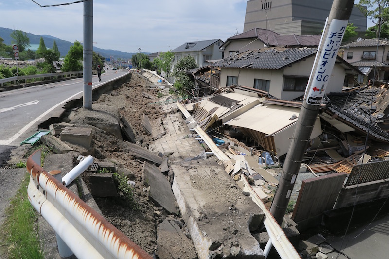
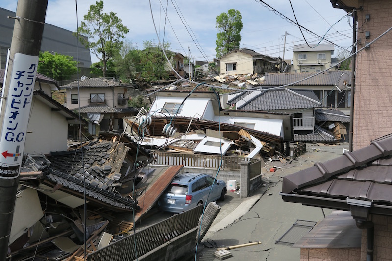
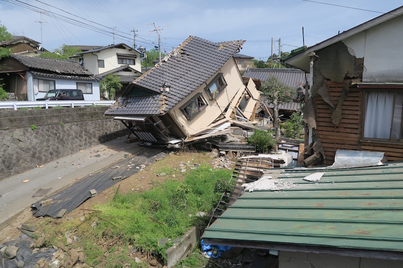
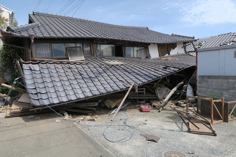
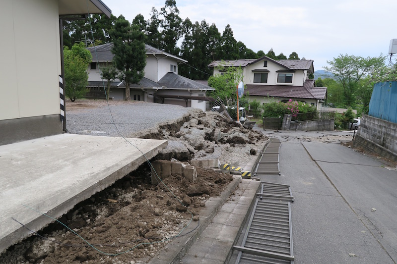
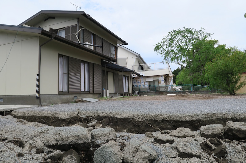
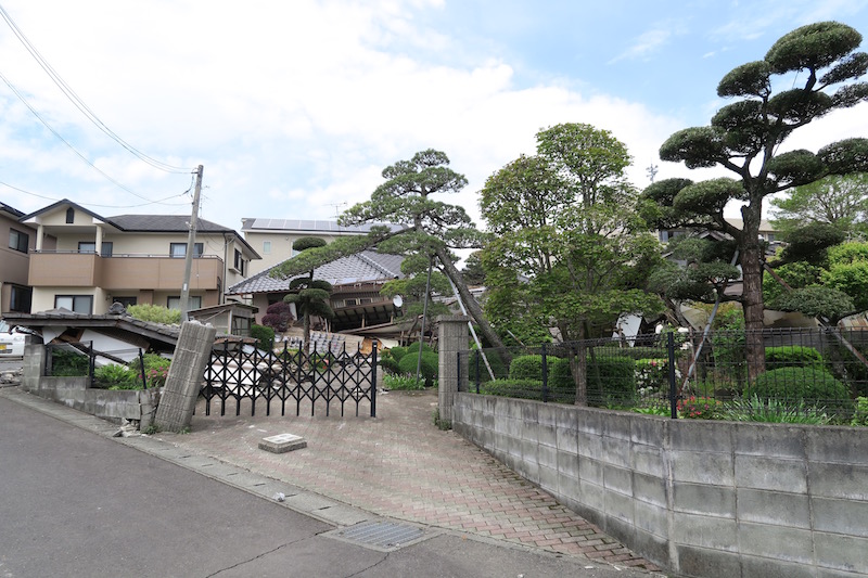
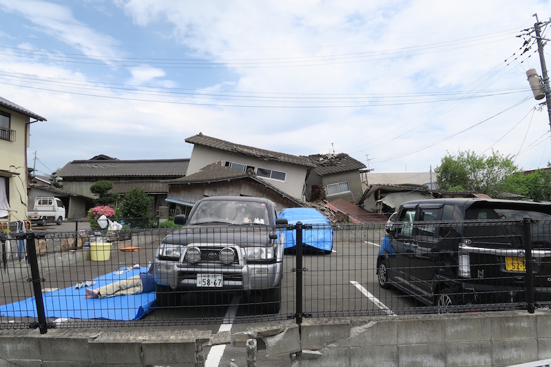
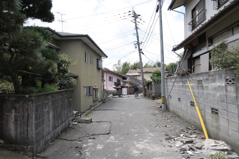
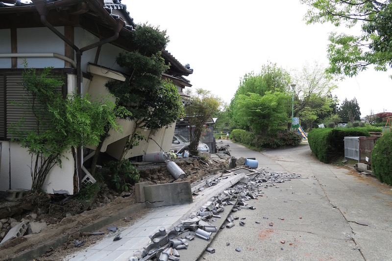
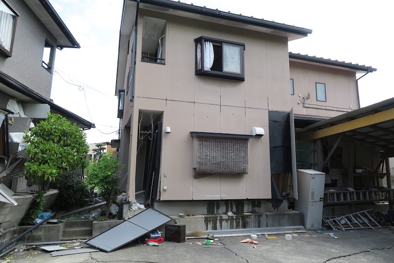
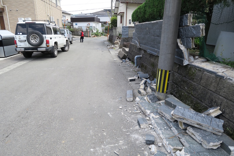
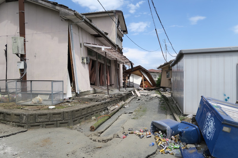
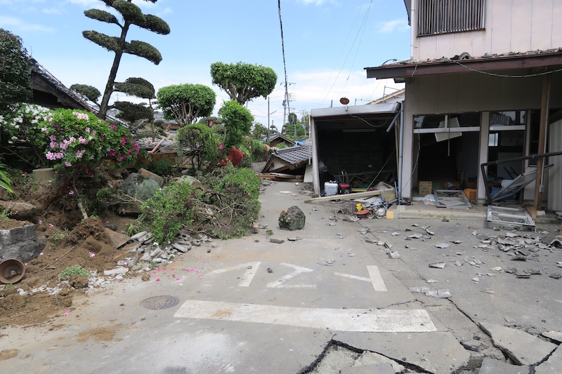
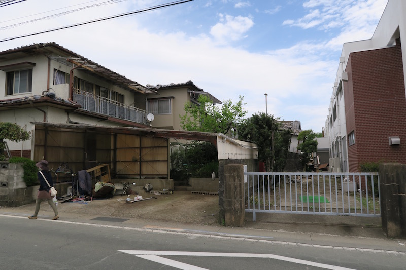
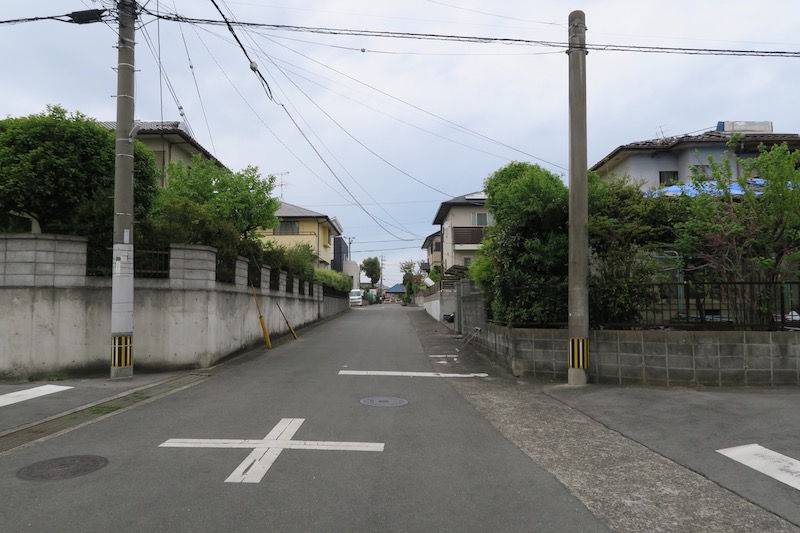
f. Mashiki town [Google Map]
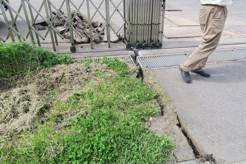
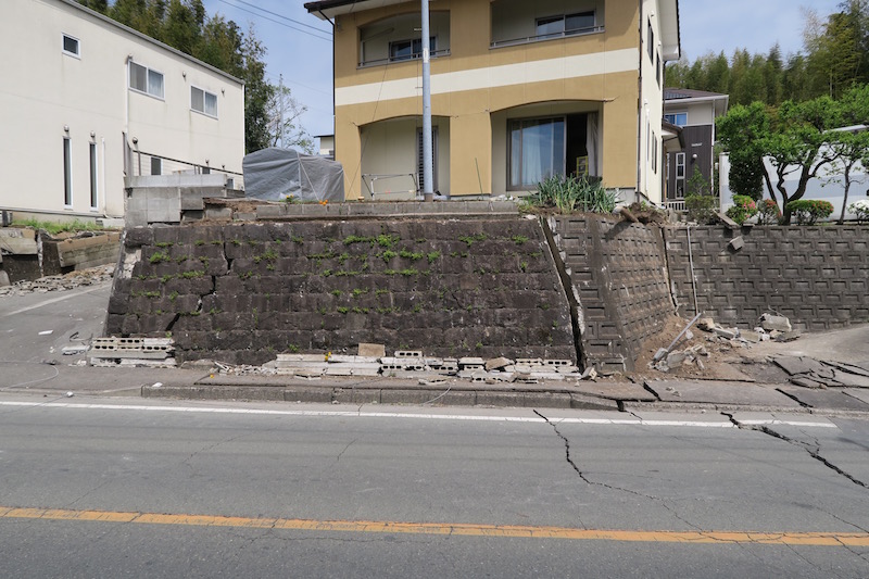
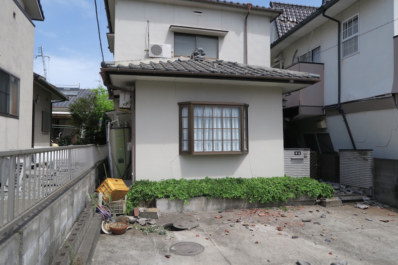
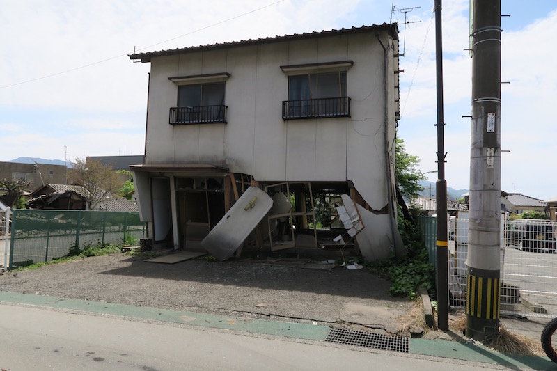
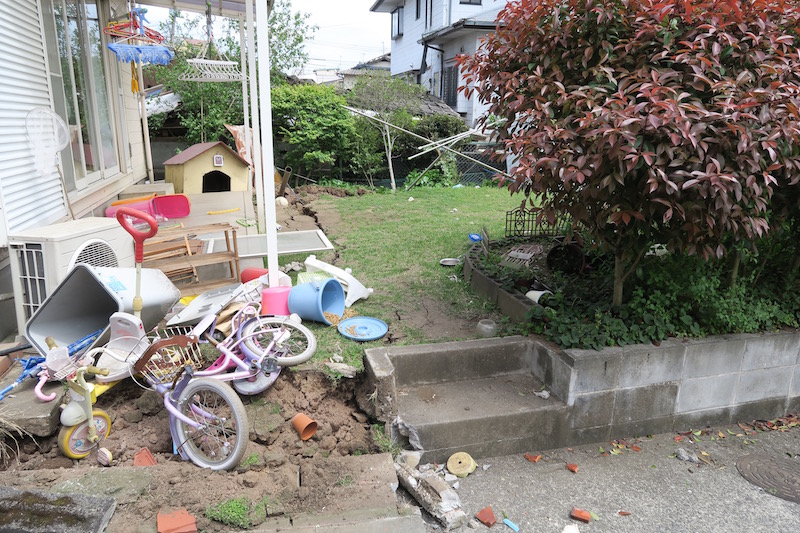
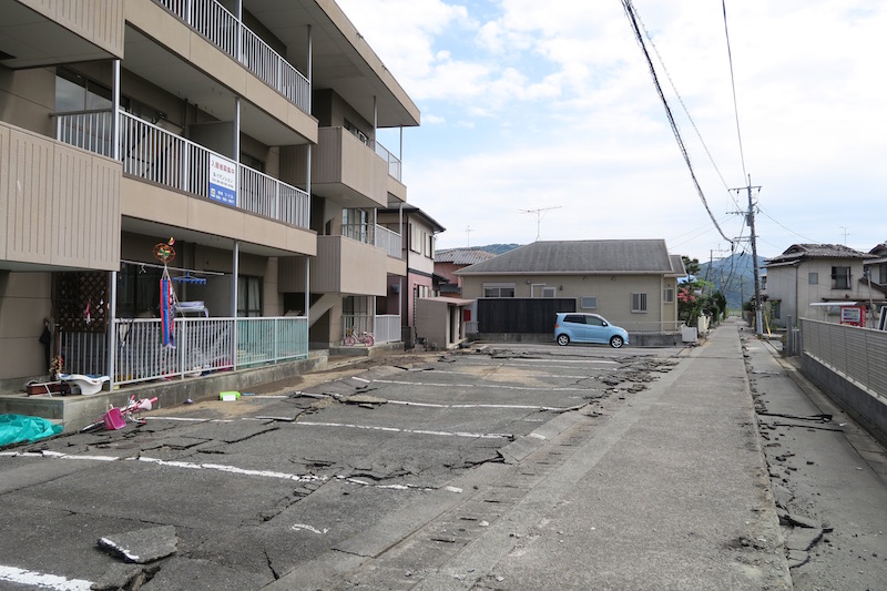
We walked from gymnastic hall to town hall in Mashiki town. Large number of hoses were collapsed or severely damaged. Topography of the area is complicated. On the other hand, damages in top and bottom of the hill were slightly moderate. Surface ground was cracked and damaged in the residential damaged area. This implies that the ground failure may be related to the structural damages.
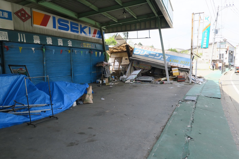
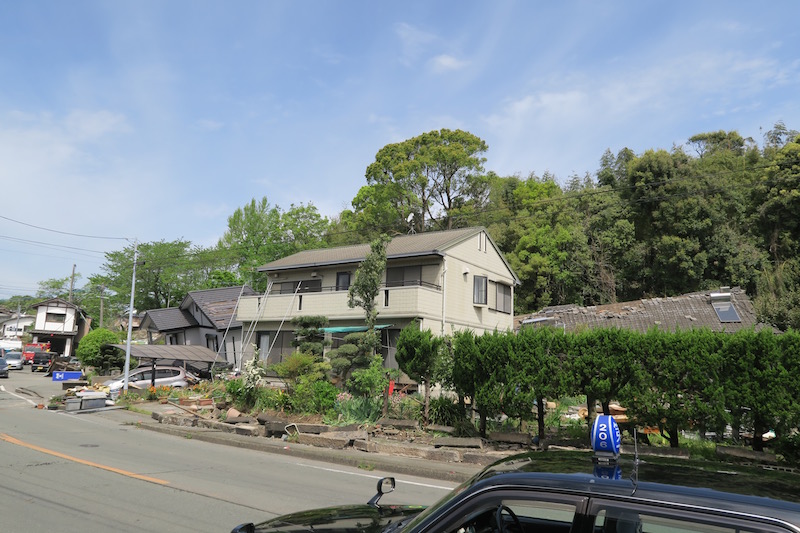
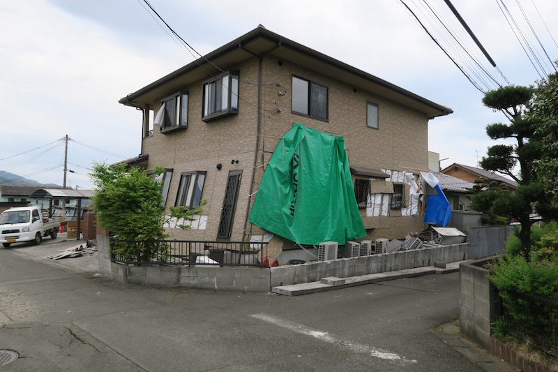
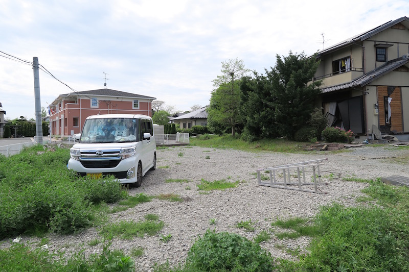
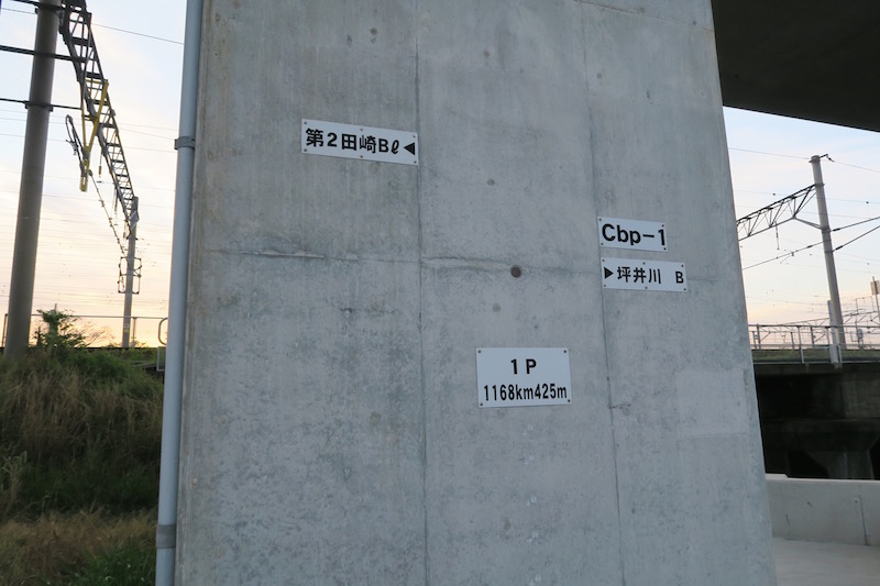
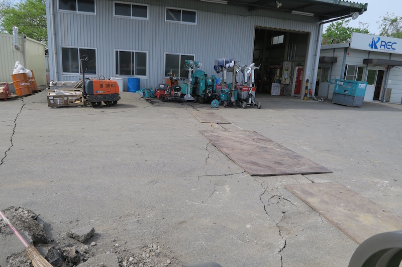
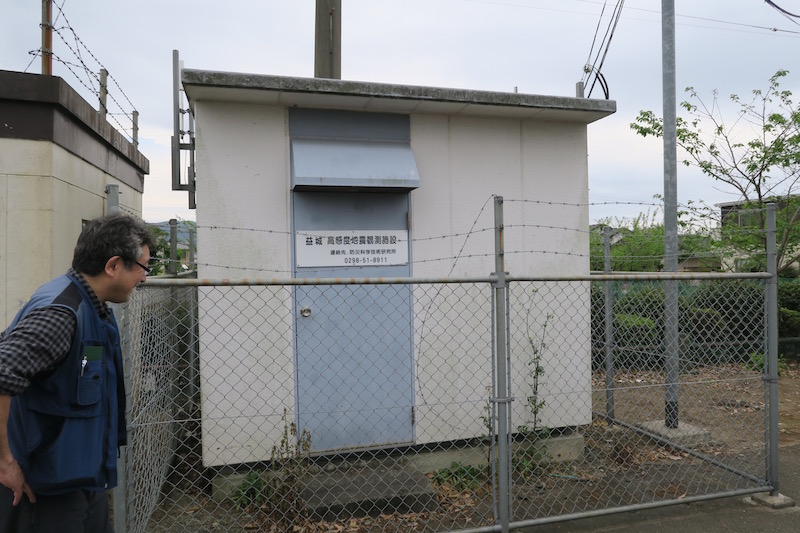
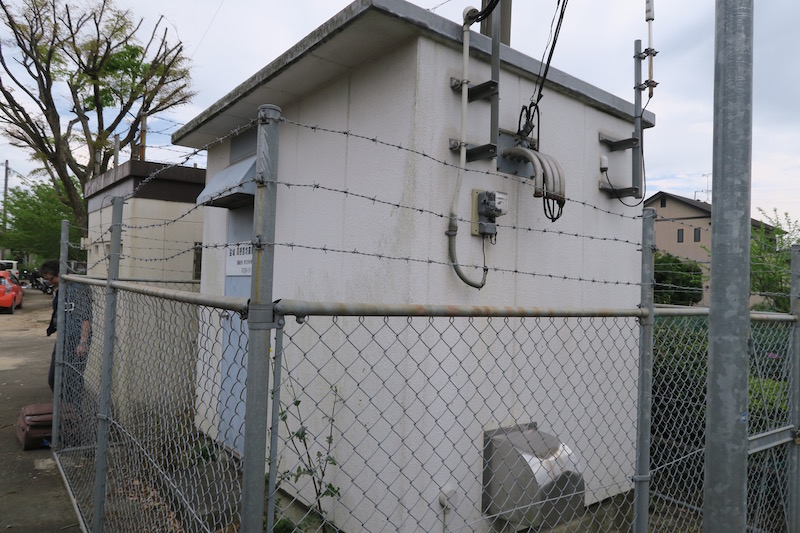
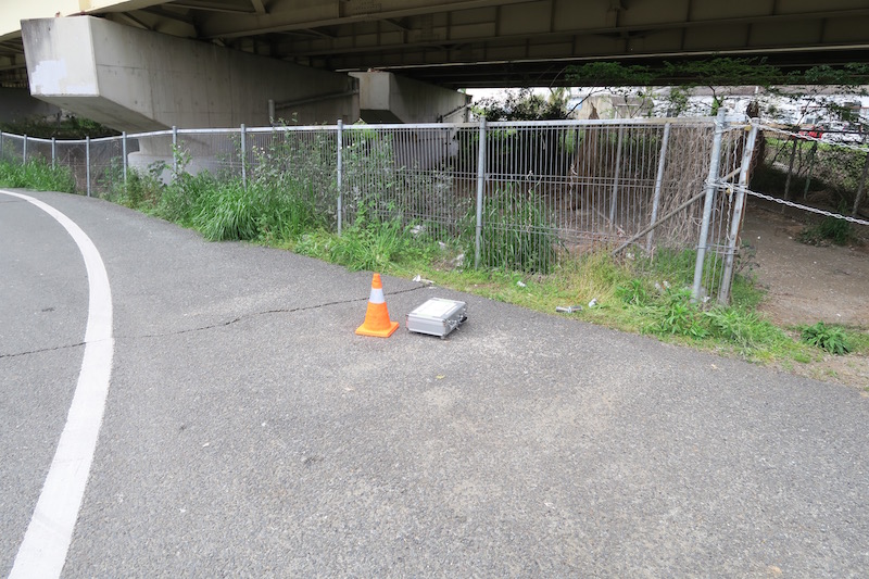
g. KiK-net KMMH16 [Google Map]
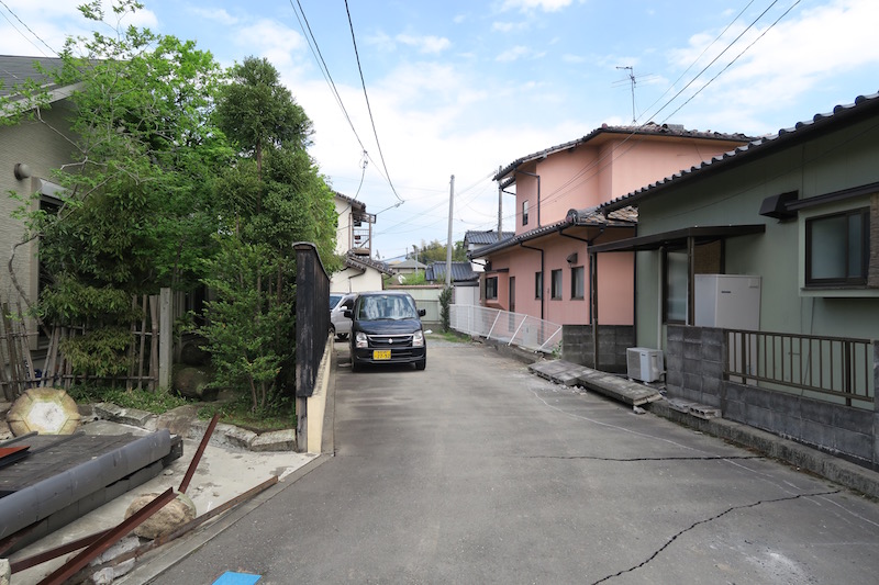
KiK-net KMMH16 station is located at 600m distance from the town hall of Mashiki town in the northerneast direction. The surrounding houses are newly constructed relative to the damaged area. Dmage lavels around the station are relatively moderate.

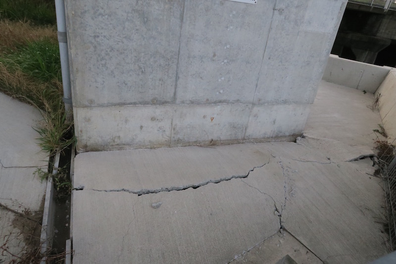
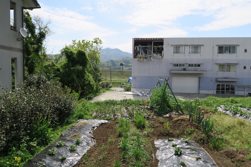
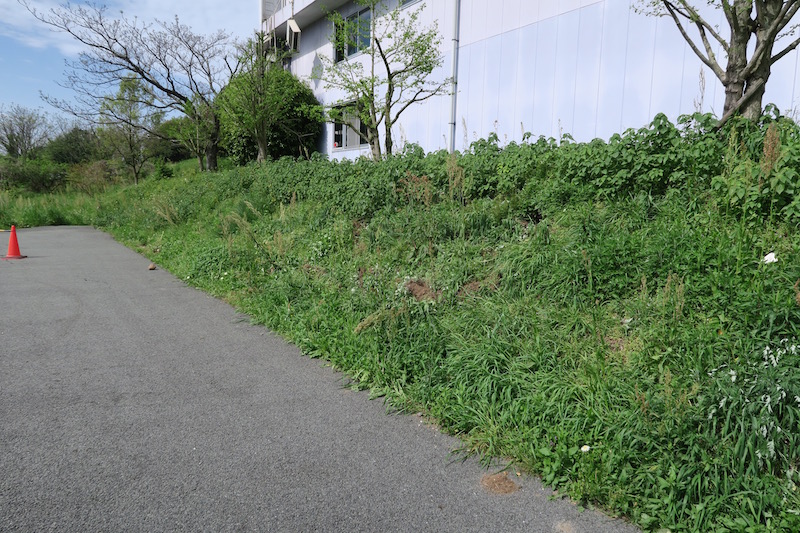
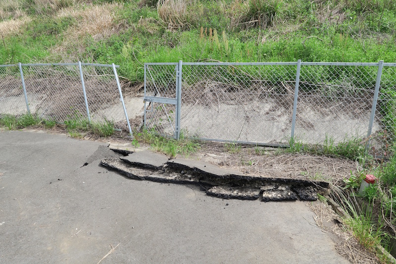
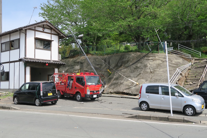
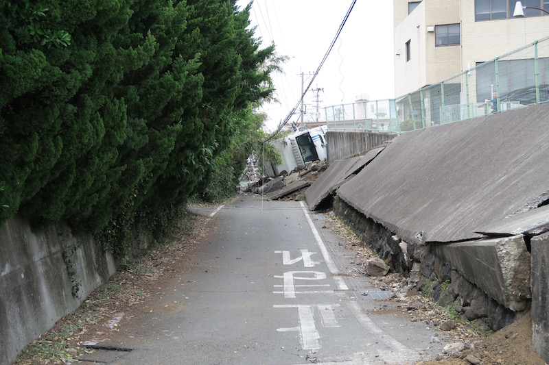
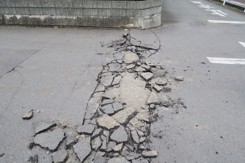
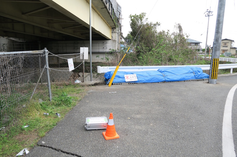
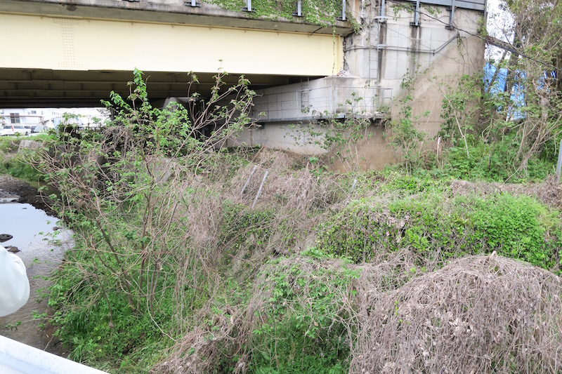
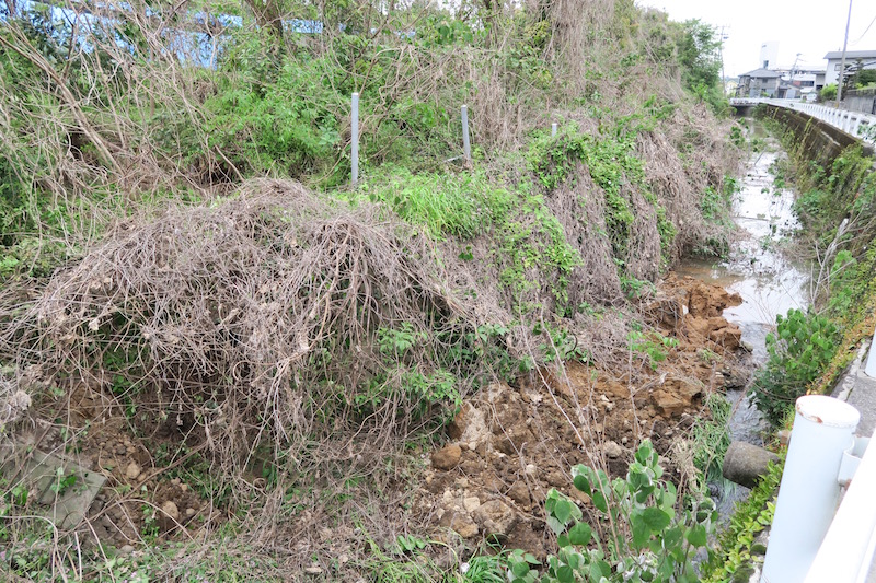
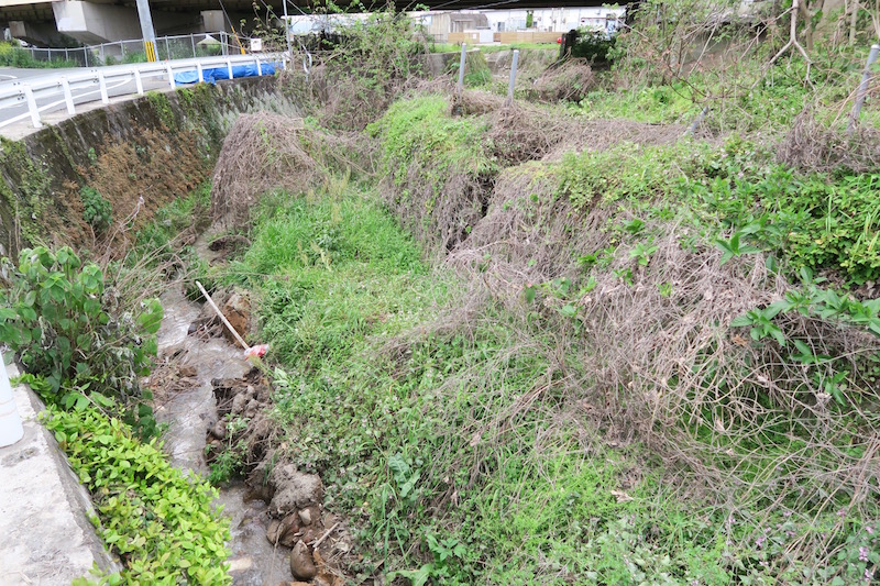
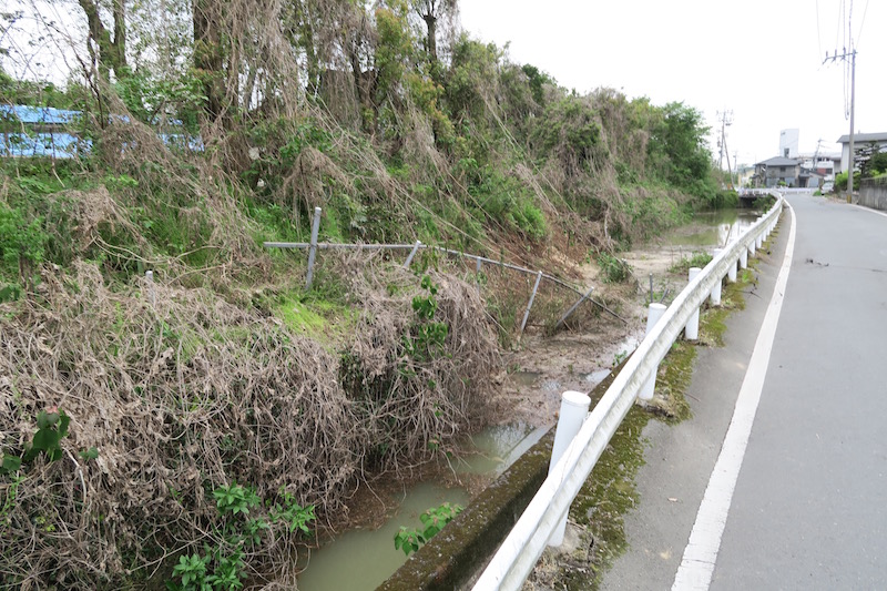
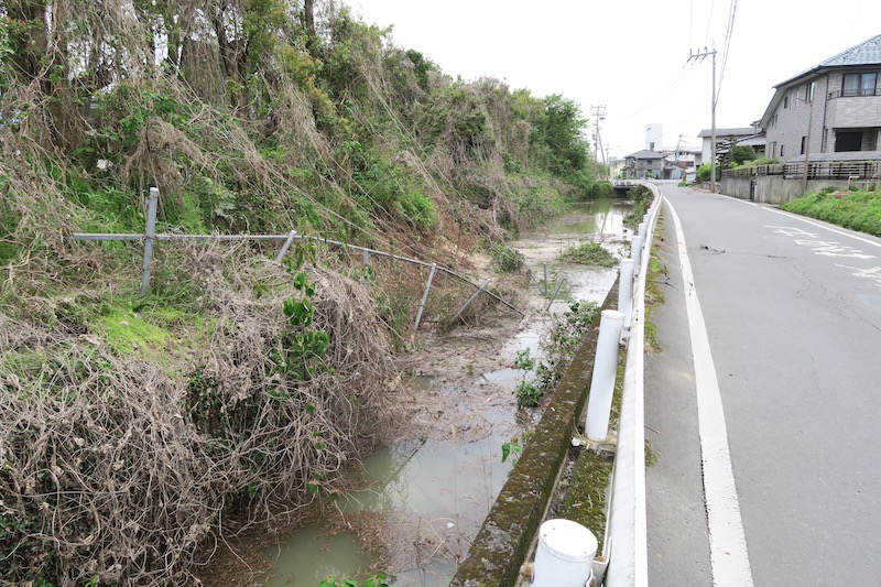
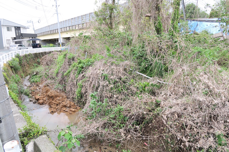
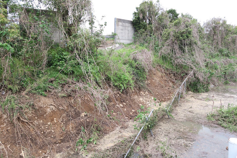
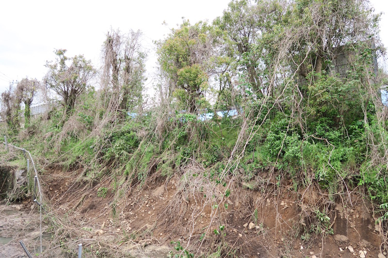
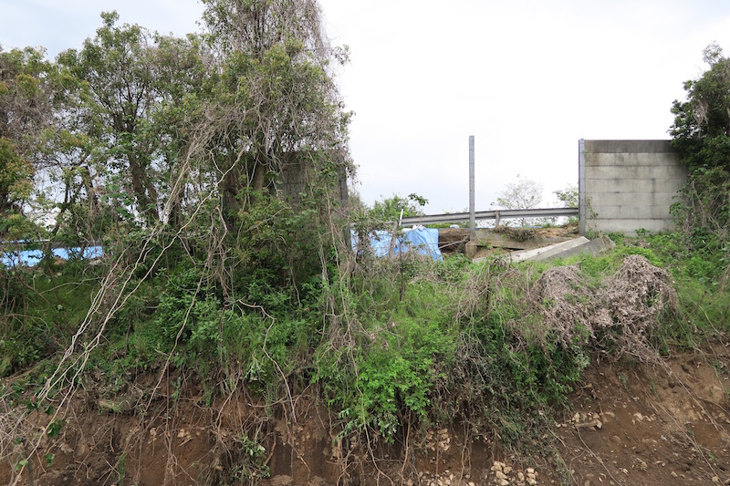
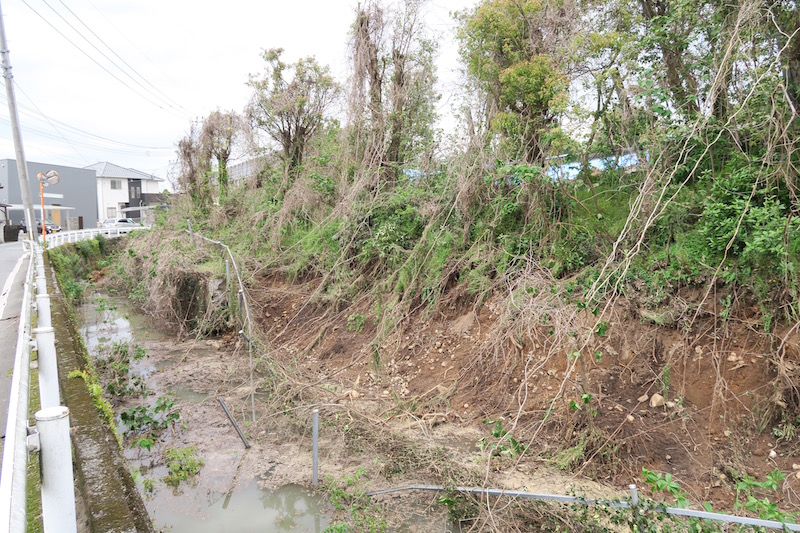
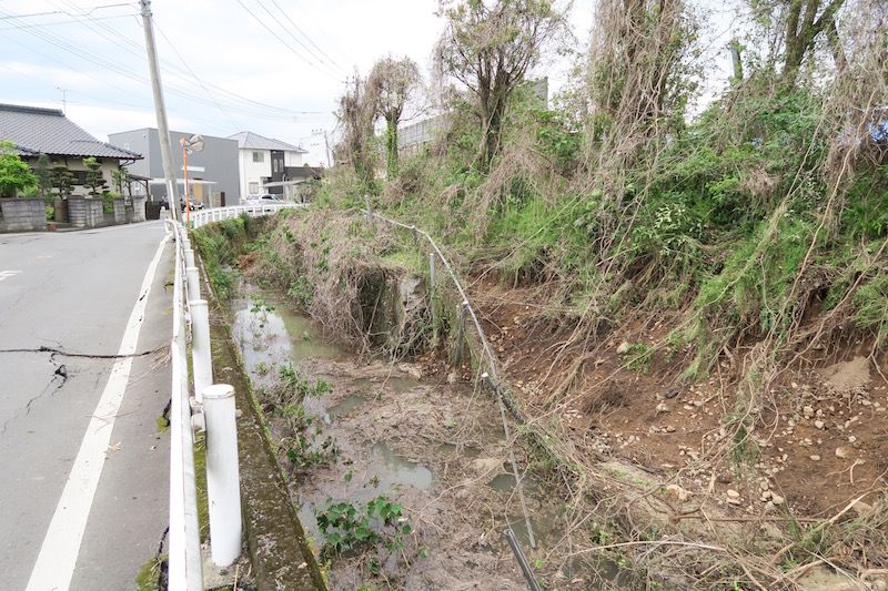
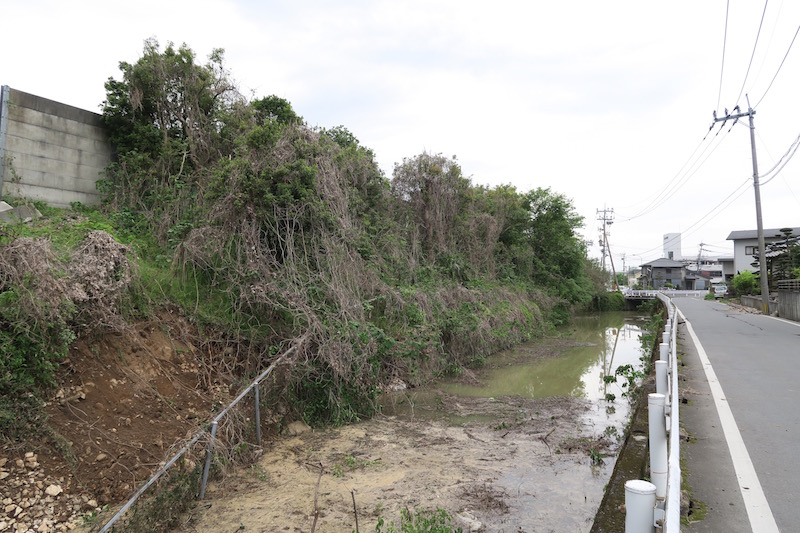
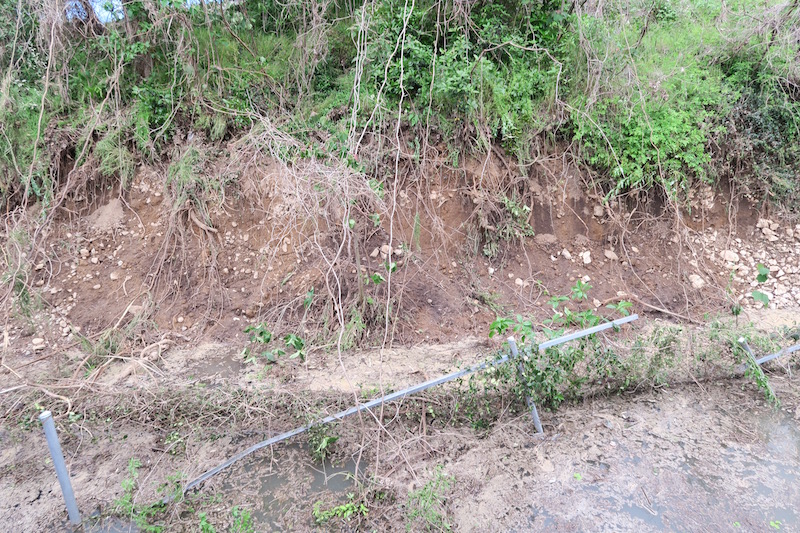
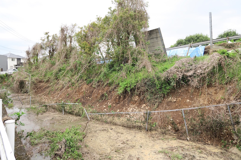
h. Embankment failure of Kyushu expressway [Google Map]
Damage of road embankment occurred in a section from Mashiki Kumamoto Airport IC to Kashima JCT in Kyushu express way. The embankment was collapsed over the slope from the crest. There is river along the embankment, and it crossed the road. It looks the result of artificial treatment. In fact, old maps clearly show the river passed by just on the failure location.

Acknowledgment
I represent the condolences toward the victims. I pray for the rapid recover of society in near future. In this report, I used K-NET and KiK-net dataset operated by NIED, and JMA records.
Reference
[1] Japan Meteorological Agency: Report for Kumamoto earthquake (No.3)
[2] Japan Meteorological Agency: Report for Kumamoto earthquake (No.7)
[3] Japan Meteorological Agency: Report for Kumamoto earthquake (No.4)
[4] F-net: Information of earthquake mechanism
By Hiroyuki Goto (Disaster Prevention Research Institute, Kyoto Univ.)