Earthquake
Report of field survey for 2009 Sumatra Earthquake [update 11, Feb. 2010]
1. Summary
The September 2009 Sumatra Earthquake (Mw 7.5)1) occured off the western coast of Sumatra island, Indonesia, on 30, September 2009 (Figure 1). OCHA reports 1,117 persons were killed or missing, and approximately 500 houses were heavily damaged2). The damaged area was concentrated in Padang city, located in the western part of Sumatra island. The details were well reported in ReliefWeb by OCHA2).
The hypocenter depth of 81km was estimated. The epicenter was located at about 60km western north of Padang. The earthquake was considered as a slab earthquake, different from the Sumatra Earthquake 2004 that was a large interplate earthquake3). The time duration of source time function was estimated to be smaller than the usual earthquakes with the same magnitude, and to be reasonable with respect to the earthquake with the same hypocenter depth. These characteristics come from the usual features of a slab earthquake.
Prof. Junji Kiyono, Dr. Yusuke Ono, Mr. Rusnardi Rahmat Putra, Mr. Masaaki Kubo, Dr. Hiroyuki Goto, and Ms. Sherliza Zaini Sooria from Kyoto University visited Padang city during 28, November to 2, December, 2009 in order to do a field survey (Figure 2). Note that the following reports might be updated without any notifications.

Figure 1: Summary map of the 2009 Sumatra Earthquake. Epicenter1),mechanism4), and the location of Padang city. The gray dots represent the epicenter of the events during a week after the earthquake ( < depth 50km).
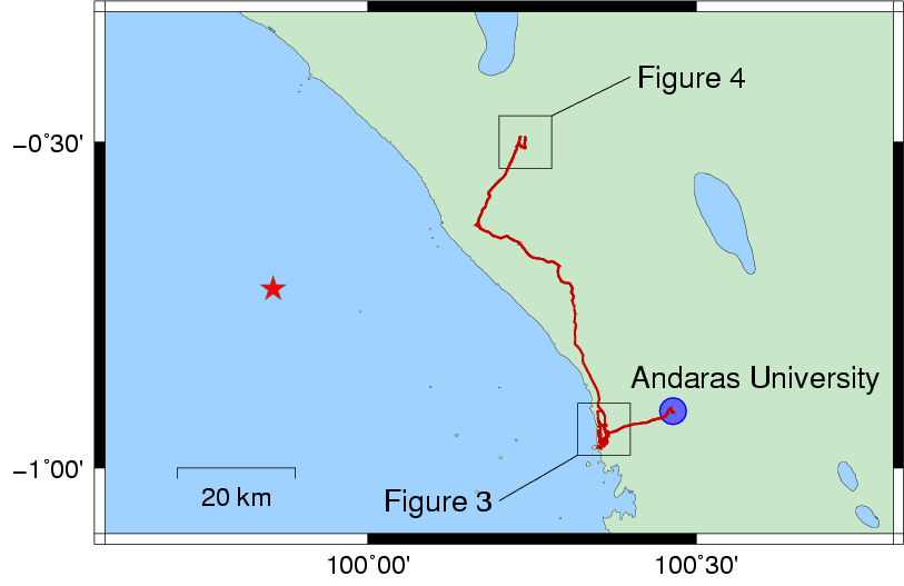
Figure 2: Route of the field survey (red line)
2. Damage patterns in Padang city
Padang is located at the western side of Sumatra island. The western side of the city is a beach on the Indian Ocean, and the downtown located between two rivers is almost flat. The left bank of the southern river consists of a steap hill with an altitude of 100-200m. The seaside road with a hight of 1-2m was considered to be a sand dune, and then the are of backswamp, where the ground motion is amplified, was expected.
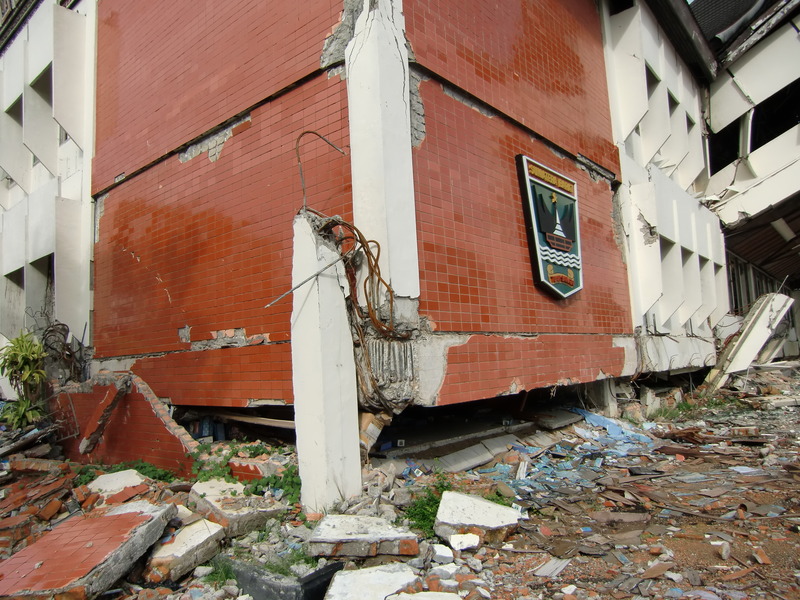
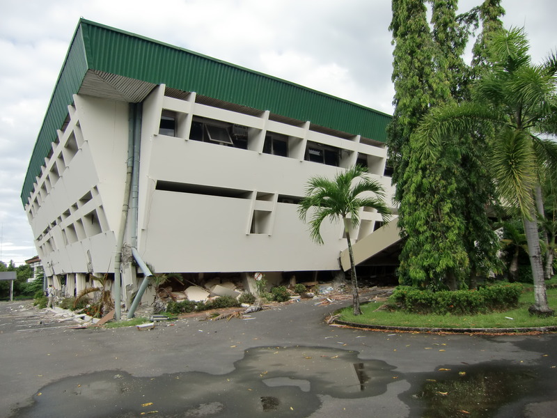
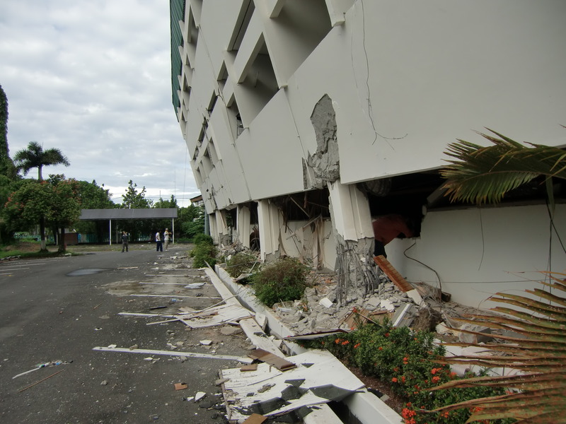
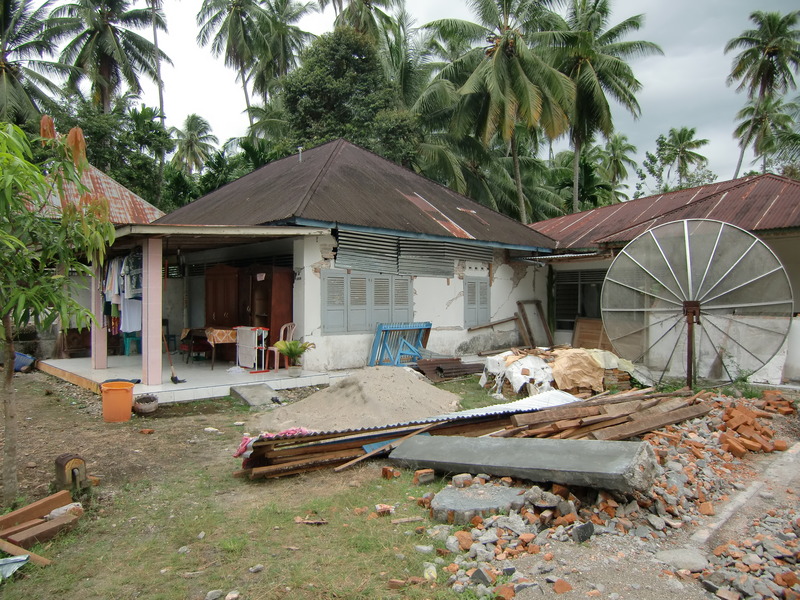
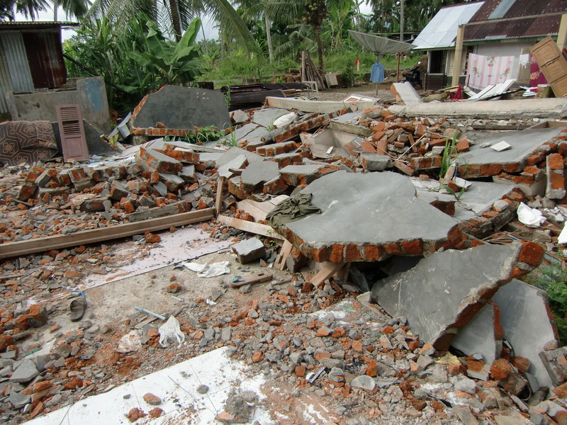
Two types of damaged buildings were observed; 1) RC buildings with three or four stories, and 2) brick houses. A number of damged RC buildings is less than the brick houses, whereas the damage was highlighted in the survey repotrs because they were impressive. Note that the damage ratio was not high, at most 10% of all the buildings. The detail number and the data are available in the other sites2). Damaged buildings show in Photo 1-3, and the locations are ploted in Figure 3.
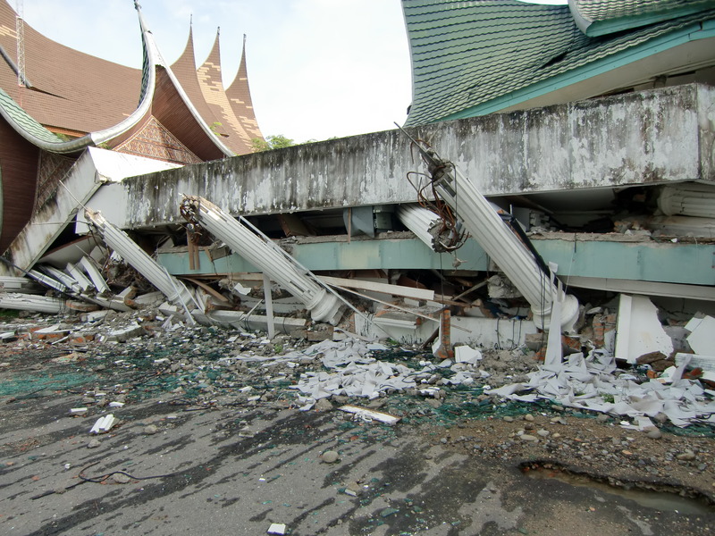
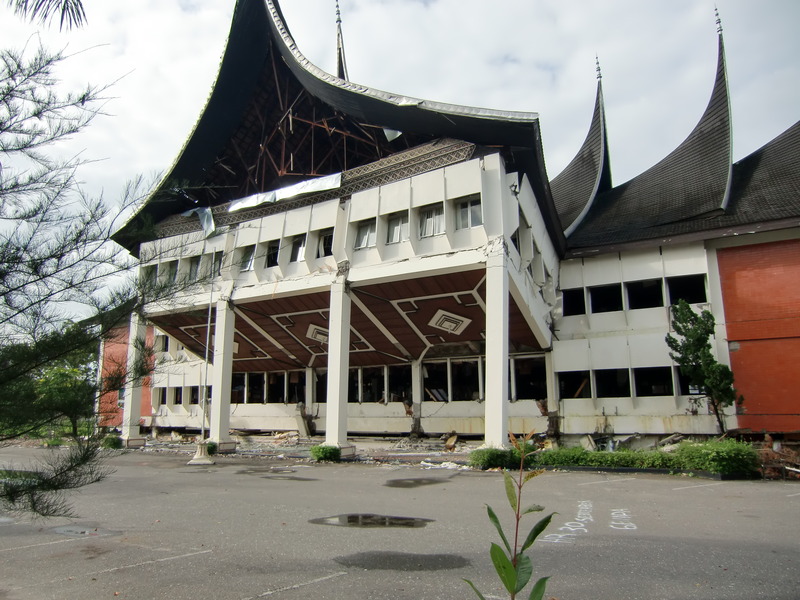
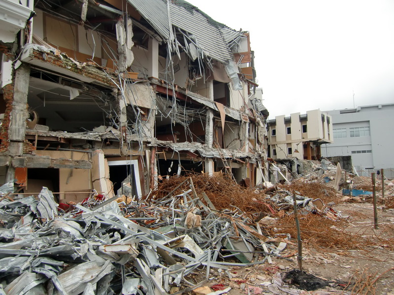
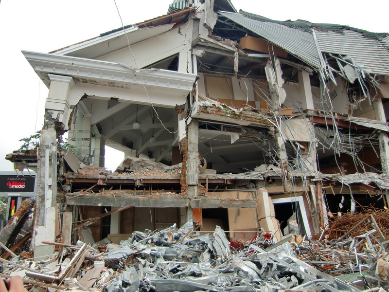
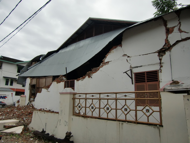
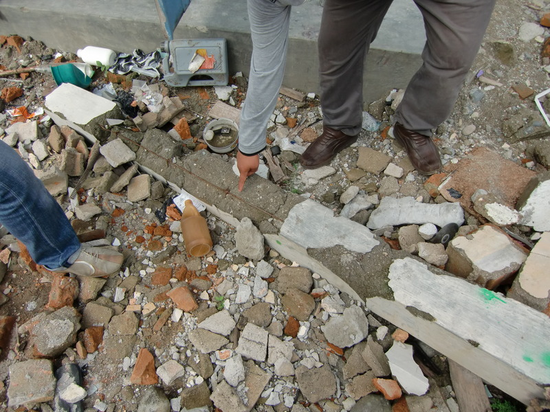
#01-04 in Photo 1 show the damaged RC buildings along Jalan Jenderal Sudirman St.: General work office (#01), Tax office (#02), Building and Planning office (#03), and Education Department (#04), which were all the goverment office. The damages were severer than the private buildings surronding them. The failure of concrete and the buckling of rebar at the connection parts between pier and beam were observed. #05 shows the damage of Ambacang Hotel.
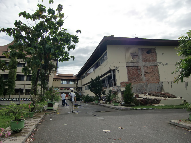
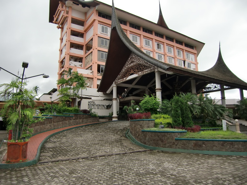
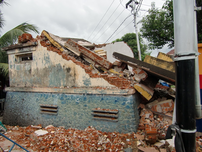
Photo 2 shows the damages of Bumiminang Hotel (#06), English school (#07), brick houses in China town (#08, #09, #10), and school in China town (#11). Their damages were concentrated on the bricks of their components. In China town, this kind of damages were significant.
- Movie.3gp -
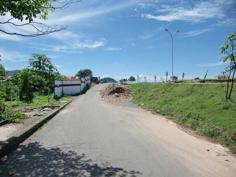
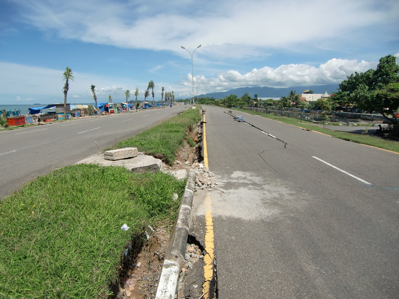
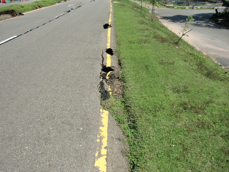
In the downtown of Padang, the damages of soil structure were quite less. Tensile failure at the top of embankment of the seaside road was observed (#12).
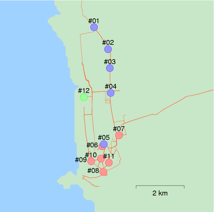
Figure 3: Locations of major damaged buildings in Padang city
 #01
#01
 #01
#01
 #02
#02
 #02
#02
 #03
#03
 #03
#03
 #04
#04
 #04
#04
 #05
#05
 #05
#05
Photo 1: General work office (#01), Tax office (#02), Building and Planning office (#03),
Education Department (#04), Ambacang Hotel (#05)
 #06
#06
 #07
#07
 #08
#08
 #09
#09
 #10
#10
 #11
#11
 #11
#11
Photo 2: Bumiminang Hotel (#06), English school (#07),
brick houses in China town (#08, #09, #10), School in China town (#11)
 #12
#12
 #12
#12
 #12
#12
 #12
#12
Photo 3: Failure of embankment of seaside road (#12)
3. Damage patterns in Padang citySago
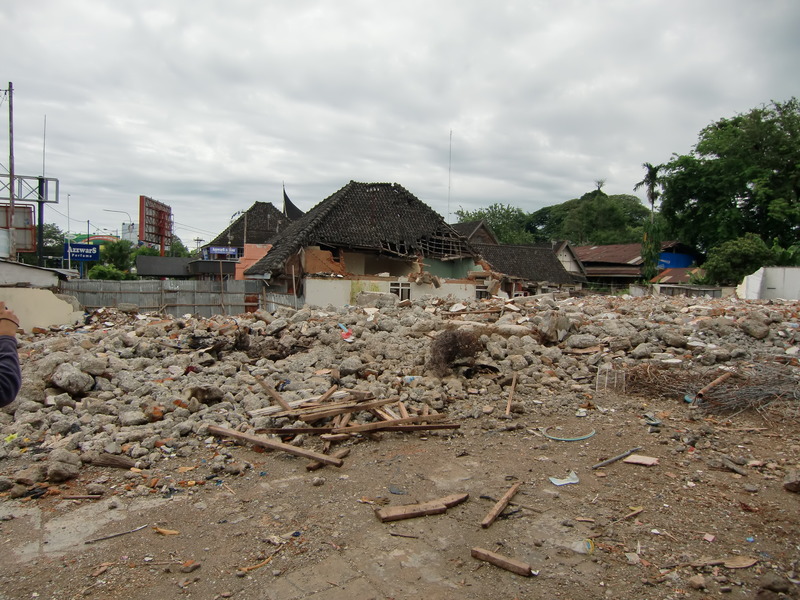
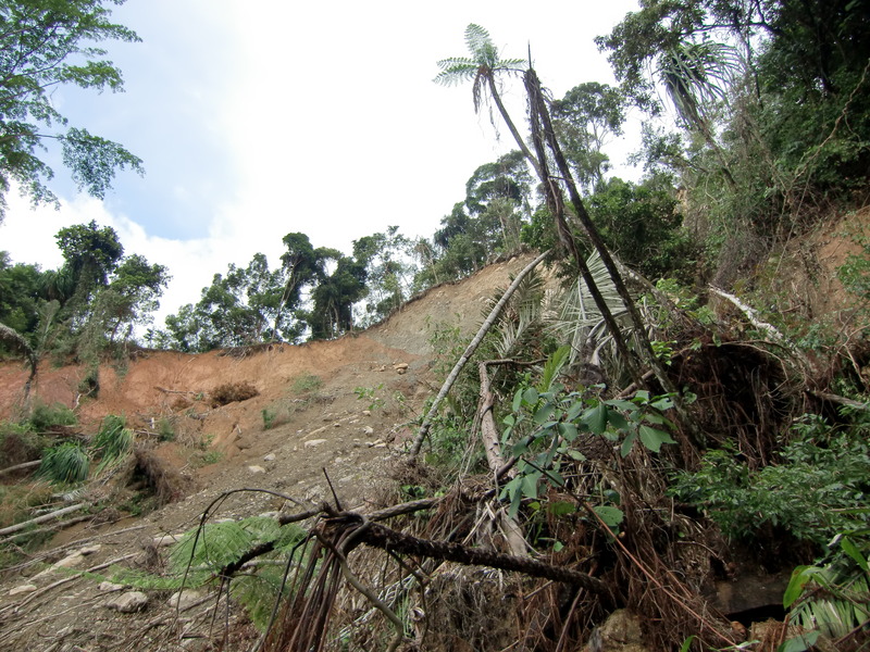
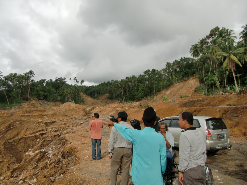
Padang Sago, where is located about 50km away from Padang city, is closer to the epicenter than Padang city, and is the mountain area with the altitude of 100-300m. There were the damges of brick houses and slope failures. Figure 4 shows the location of survey area, and Photo 4-5 show the damages.
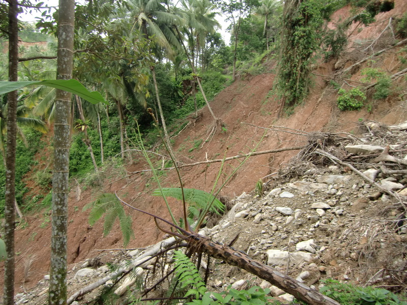
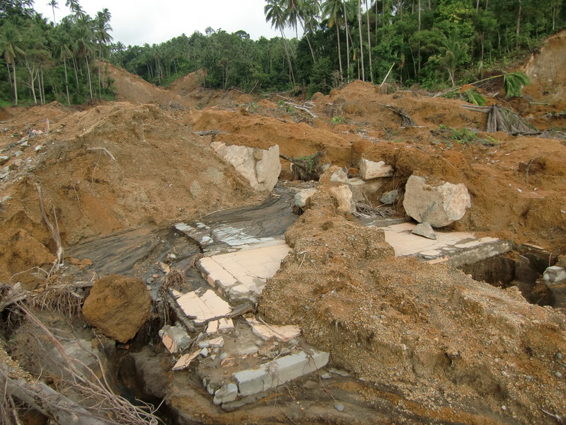
Majority of the residences in Padang Sago was the brick houses without any reinforcements. The damaged houses were almost untouched during about two monthes after the earthquake (#13). The road to the mountain side of the villege was not available because of the slope failure (#16). Another villege was covered with the mudflow of about 1m (#17).
- Movie.3gp -
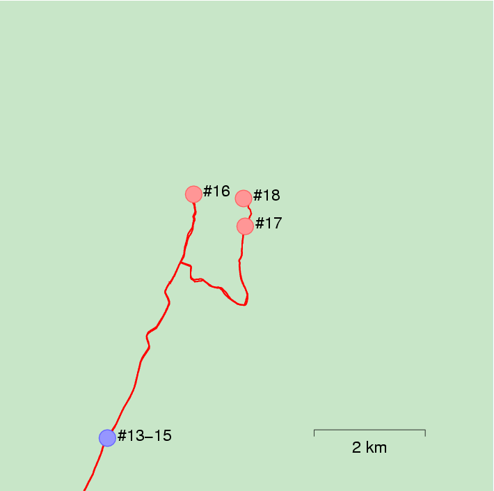
Figure 4: Locations of the visited sites in Padang Sago
 #13
#13
 #14
#14
 #15
#15
 #15
#15
Photo 4: Damaged residences (#13, #14, #15)
 #16
#16
 #16
#16
 #17
#17
 #17
#17
 #17
#17
 #18
#18
 #18
#18
 #18
#18
Photo 5: Slope failure (#16), mudflow (#17), and landslide (#18)
4.まとめ
Severe damages of the building with low seismic capacity occured in both Padang city and Padang Sago. However, damaged residences were concentrated in China town in Padang city. Because the depth of hypocenter was relatively deep, the differences of the damage ratio might be related to the difference of the ground motion that means the difference of site amplifications.
Acknowledgment
The field survey was supported by "Global Center for Education and Research on Human Security Engineering for Asian Megacities", Kyoto University. We appreciate many researchers and local engineerers for providing a great information and kind arrangements.
Reference
1) USGS: Magnitude 7.5 - SOUTHERN SUMATRA, INDONESIA
2) ReliefWeb, OCHA: Indonesia: Sumatra Earthquake - Sep 2009
3) Earthquake Research Institute, Univ. of Tokyo: Report on the Earthquake Off Sumatra Islands
4) NIED: Southern Sumatra, Indonesia, September 30, 2009, 10:16 (UTC) (Mw 7.5)
Hiroyuki Goto(Disaster Prevention Research Institute, Kyoto University)